





Delmarva will enjoy a warm and mostly pleasant Thursday with hazy sunshine and highs in the upper 80s to low 90s. A cold front will slowly move south through Friday, eventually ushering in cooler and less humid weather for Saturday. Saturday looks like the pick of the weekend before humidity and storm chances return Sunday afternoon into Monday. A low rip current risk is expected today, while spotty minor tidal flooding will be possible along portions of the Delmarva coast during Thursday evening’s high tide.
From
To

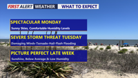
Delmarva will enjoy one more pleasant and mostly sunny day Monday before humidity, showers and strong thunderstorms return Tuesday.

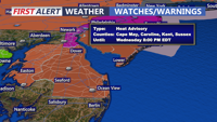
A sunny and increasingly hot Tuesday will lead into dangerous heat Wednesday, followed by a potentially stormy weekend across Delmarva.

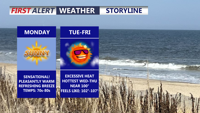
Sunshine, low humidity and comfortable temperatures will make Monday one of the nicest July days on Delmarva before heat and humidity build through midweek.

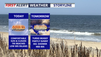
Delmarva will enjoy a comfortable start to the forecast period with mild humidity, cooler beaches, and a mix of sun and clouds today. Humidity climbs Wednesday before Thursday brings the hottest conditions of the week, gusty winds, and the potential for severe thunderstorms. The weekend looks much more pleasant, with mostly sunny skies Saturday and a warm Father’s Day to welcome the first day of summer.

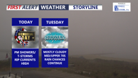
Delmarva will see a mild but unsettled Memorial Day with showers and a brief downpour or gusty thunderstorm possible late this afternoon into the evening. Highs will reach the mid 70s with southwest winds near 20 mph. Rainfall could total 1 to 2 inches in spots, and a high rip current risk continues along the beaches. More scattered showers remain possible Tuesday and Wednesday before drier weather returns late this week.


Today stays warm and sunny across Delmarva, but temperatures step down from yesterday’s record highs. Cooler air arrives near the coast Saturday as a backdoor front pushes in, while inland areas stay milder. Minor tidal flooding is expected along the Delaware coast and Delaware Bay Saturday evening into Saturday night, followed by showers, a few thunderstorms, and a sharp cool down late Saturday night into Sunday. Much colder air settles in early next week, with widespread frost or freeze conditions likely Monday night into Tuesday morning.

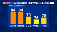
Delmarva will enjoy sunshine and warmer temperatures Saturday, partly cloudy Sunday with an isolated chance for showers and thunderstorms arrive Sunday night with an approaching cold front. Another front moves through Tuesday, setting up cooler, drier weather midweek.

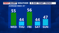
Sussex County and Delmarva beaches face strong winds Wednesday as a cold front passes, with colder temperatures and potential wintry precipitation arriving Thursday night.

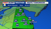
Sussex County and Delmarva beaches brace for gusty winds Wednesday as a cold front sweeps through, followed by another system bringing rain and potential wintry precipitation later in the week.