

Storyline

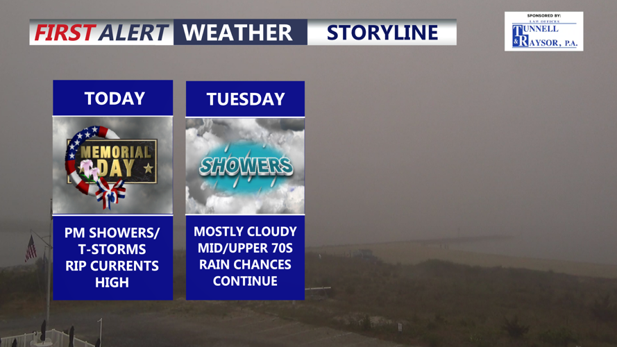
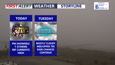
Unsettled conditions continue, rain, heavy at times through the evening. HIGH rip current risk continues.

DELMARVA -- Unsettled weather continues across Delmarva today as Memorial Day brings mild temperatures, showers and the chance for a brief downpour or gusty thunderstorm later this afternoon into the evening.

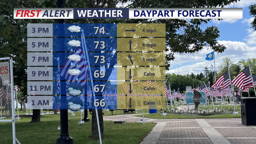
Memorial Day Daypart

Showers and downpours develop this afternoon-evening.

Highs will climb into the mid 70s with southwest winds around 20 mph. Low pressure over the eastern Great Lakes and Ohio Valley will lift northeast through the day, helping pull a warm front north across much of the region this morning. That front will linger nearby before a cold front moves through Delmarva later this afternoon and tonight.

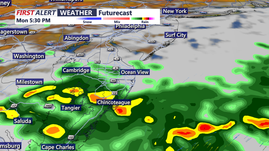
Futurecast

Another round of rain and embedded thunderstorms this afternoon-evening.

As the cold front crosses the area, rain and a brief thunderstorm will become possible. Some of the stronger storms could produce locally heavy rain and gusty winds. Rainfall totals may reach 1 to 2 inches in some areas.

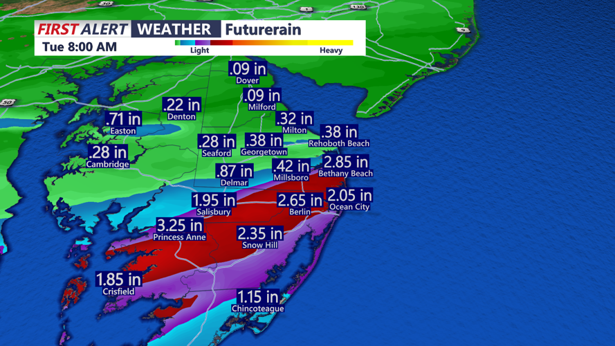
Futurerain

An additional 1 to 2 inches of rain through this evening, highest totals trending in the southern half of the peninsula. 

At the beaches, a high rip current risk continues. Waves will run 2 to 4 feet, with ocean water temperatures in the upper 50s. Anyone heading to the coast should use caution and follow local beach patrol guidance.

Tonight, patchy fog and low clouds may redevelop across parts of Delmarva. Overnight lows will settle into the low to mid 60s.

The cold front will sink south of the area on Tuesday but remain close enough to keep some showers possible across portions of Delmarva. Highs Tuesday will reach the mid 70s to low 80s, with cooler conditions near the coast.

Another cold front will move south on Wednesday, while the nearby boundary to the south keeps additional rain shower chances in the forecast for parts of Delmarva. Temperatures Wednesday will reach the upper 70s to mid 80s, again running cooler along the coast.

Drier weather is expected to return during the second half of the week as high pressure builds in. Thursday and Friday should bring more comfortable conditions, with highs both days reaching into the 70s.


Meteorologist

Chris Mastrobuono is a South Philly native, but has come to join the CoastTV meteorology team. With over three years of experience delivering accurate, passionate and insightful weather analysis, he is eager to report on the coast. Previously, he spent over two years as a morning meteorologist at WEVV CBS/FOX in Evansville, Indiana. 

Recommended for you