





High pressure keeps Delmarva cold and mainly dry through the weekend, with only a slight chance of precipitation late Saturday night before milder air arrives by midweek.
From
To


A stalled front will keep beach areas cool and damp into Tuesday while inland Sussex County sees a transition to warmer, more humid conditions with afternoon storm chances.


Delmarva starts the week with marine clouds and patchy fog as an onshore flow keeps skies gray and temperatures mild. A cold front will bring showers and a low-end severe threat Tuesday before high pressure brings sunshine and near 90-degree warmth by midweek. Rain chances return by the weekend as another front approaches.

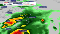
While severe storms remain west and south of the region, Delmarva starts the week under persistent cloud cover, patchy fog, and a low-end risk of isolated storms as a cold front approaches. Warmer, sunnier days are on the horizon by midweek.

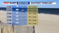
Delmarva faces a marginal risk for severe storms Sunday afternoon and evening as a frontal boundary stalls over the region. Showers and thunderstorms—some potentially strong with damaging winds and isolated tornadoes—could impact parts of the peninsula, especially the southwest. Quieter weather returns Monday before another round of rain and storms arrives Tuesday. The second half of the week turns drier and significantly warmer, with highs reaching the 80s and possibly nearing 90.

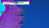
A mix of fog, showers, and isolated thunderstorms will affect coastal Sussex County from early Tuesday into Wednesday night, with some clearing expected midweek before another round of unsettled weather.

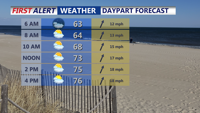
A strong cold front is expected to move through Delmarva late Monday, bringing the potential for strong to severe thunderstorms, heavy rainfall, and localized flooding. The worst of the weather is expected between 8 p.m. and 3 a.m. Tuesday. Cooler and drier conditions return Tuesday, but unsettled weather is likely to end the week.