


DELMARVA -- Sunday brought more cloud cover and damp conditions across the region, as an east wind and marine layer continued to dominate. Despite multiple tornado and severe thunderstorm warnings across areas west and south of the peninsula, Delmarva remained free from any active watches or warnings Sunday evening.
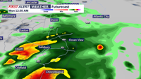
Overall the atmosphere stayed stable through the day, causing storms attempting to cross the bay to weaken or fall apart before reaching the area. However, as a warm front lifts northward Sunday night, there's a low-confidence chance for an isolated strong storm or brief downpour—especially across the Eastern Shore and southern Delmarva.
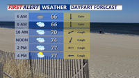
Conditions will remain mild and muggy through the night, with lows dipping into the mid-60s. Patchy fog and drizzle are expected by daybreak Monday as low-level clouds remain firmly in place, fueled by persistent onshore flow.

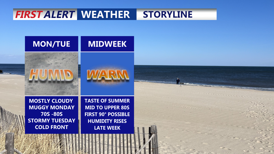
Mostly cloudy humid Monday, stormy Tuesday, before summer-like weather builds in mid to late week.
Little will change to start the workweek. The marine influence continues, keeping skies mostly cloudy and damp with the possibility of a few spotty showers or drizzles, especially in the afternoon and evening. Highs will climb into the low to mid-70s inland and near 80 degrees away from the coast.

Mostly cloudy, some breaks in the clouds, isolated shower late, highs in the upper 70s to near 80 away from the coast.
A cold front pushing in from the west Monday night will bring another chance for showers and isolated thunderstorms, particularly overnight and into Tuesday morning. While a strong storm cannot be ruled out—especially with modest atmospheric forcing—overall instability is expected to remain low, keeping the risk of severe weather marginal. The Storm Prediction Center has placed the region in a Level 1 out of 5 Marginal Risk, with damaging wind gusts being the main concern.
Rainfall totals from this round of showers are expected to range from a quarter to three-quarters of an inch. Highs Tuesday will range from the mid-70s to low 80s, with a cooler, clearer night to follow.

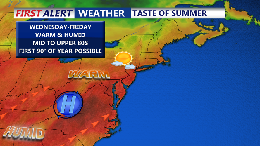
High pressure settles in midweek and we see temperatures push to near 90 Thursday and Friday.
High pressure takes hold on Wednesday and Thursday, bringing the return of sunshine and unseasonably warm temperatures. Highs will reach into the low to mid-80s Wednesday, with even warmer readings approaching the upper 80s to near 90 degrees by Thursday and Friday—possibly marking the first 90-degree day of the year for parts of the region.
The next weather system arrives by Saturday as a cold front stalls near the area. This may lead to unsettled weather with renewed chances for showers and storms through the weekend. Temperatures will dip closer to seasonal or slightly below-normal levels as the front moves through.