


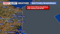


DELMARVA -- Monday begins with familiar gray skies and fog, and a persistent onshore flow and marine stratus deck held firm across the region. A dense marine fog advisory is in effect for the Delaware coast until 2PM.

In effect until 2PM Monday for the Delaware coast, visibility down to 1/4 mile or less.
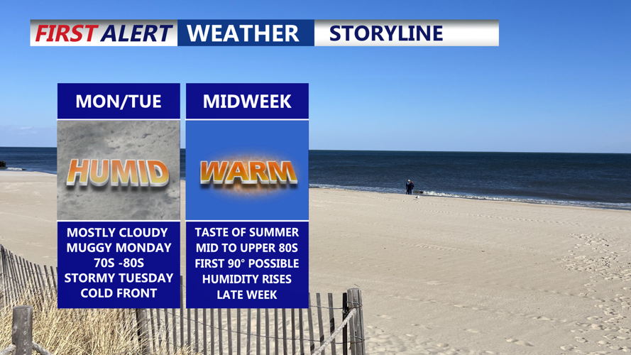
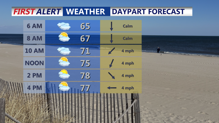
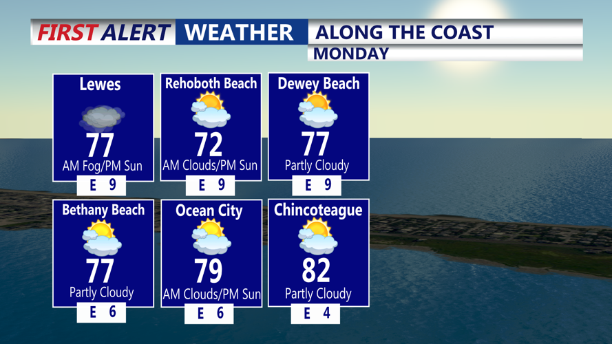
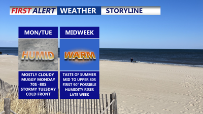
While some breaks in the clouds may allow temperatures to reach near 80 degrees inland, most of the area will remain in the low to mid-70s under a mostly cloudy skies, an isolated shower is possible.

Mostly cloudy Monday, some breaks of sun, isolated shower possible late afternoon.

Foggy start, some breaks of sun into the afternoon with highs in the 70s to 80 in some spots, isolated shower can't be ruled out.
This damp pattern continues through Monday night as a cold front begins pushing eastward from the Ohio Valley. That front will bring another round of showers and isolated thunderstorms to Delmarva, primarily overnight into early Tuesday.
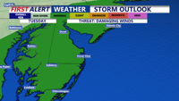
The Storm Prediction Center (SPC) has outlined the region in a Marginal Risk (1 out of 5) for severe weather. While instability and wind shear will be limited, strong upper-level forcing could spark a few strong storms. Any severe weather that develops may be capable of damaging wind gusts, though the overall threat remains low. Rainfall totals from this system are expected to range from 0.25 to 0.75 inches.

Storm Prediction Center has the peninsula under a "Marginal" (1 of 5) severe risk Tuesday, damaging winds are possible.
Tuesday will bring highs in the mid-70s to low 80s before drier air arrives late in the day. Skies begin to clear Tuesday night, setting the stage for a dramatic weather turnaround.
By Wednesday, high pressure will settle over the region, delivering sunshine, low humidity, and warming temperatures. Highs will climb into the low to mid-80s Wednesday, followed by upper 80s to near 90 degrees Thursday and Friday. Inland areas could see their first 90-degree readings of the year as summer-like warmth takes hold.
The weather pattern becomes more unsettled again by the weekend as another cold front drifts southward. Forecast models suggest the front could stall near the area, bringing an increased risk of showers and thunderstorms, especially Saturday. Behind the front, temperatures will trend closer to seasonal normals, or even slightly below average.
