


Quiet weather settles across Delmarva into the weekend.
From
To

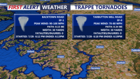
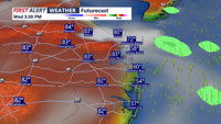
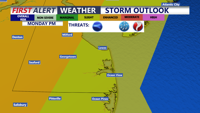
The atmosphere is becoming unstable and getting primed for a threat of severe weather this evening.

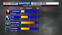
A quiet start to Sunday. Then windy, humid, and hot conditions this afternoon with a chance of evening severe storms.

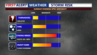
Quiet conditions through early Sunday, then a threat for severe weather later in the day.

A cold front is sweeping away the humidity, but it remains hot for the start of the weekend.

The stretch of dangerous heat and humidity continues, with a continued risk for strong to severe thunderstorms.

Today looks to be the warmest day of the stretch, with partly cloudy skies, and inland highs reaching the low to mid 80s.

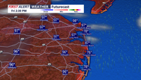
Big warm up today with 70s, then rainy and colder conditions Friday.

Windy day on the way, with a threat for severe weather later today.

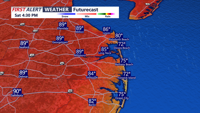
DELMARVA- High pressure continues to slide off the coast today, ushering in warmer air and breezy conditions. A Yellow Alert is in effect for …