



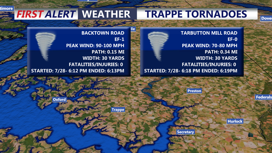



DELMARVA - There were two tornadoes observed in the Trappe area Tuesday evening. They were short lived, with one being an EF-0, while the other was an EF-1. Some structural damage was observed with the stronger tornado, with a roof torn off an industrial building.

Skies will be mostly clear this morning as high pressure moves into the region. Temperatures will settle into the mid 60s, setting the stage for a stretch of dry weather through much of the weekend.

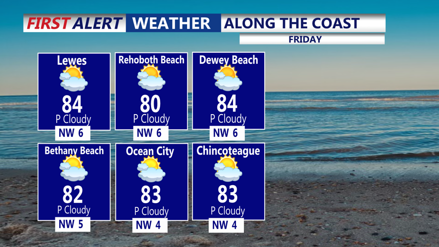
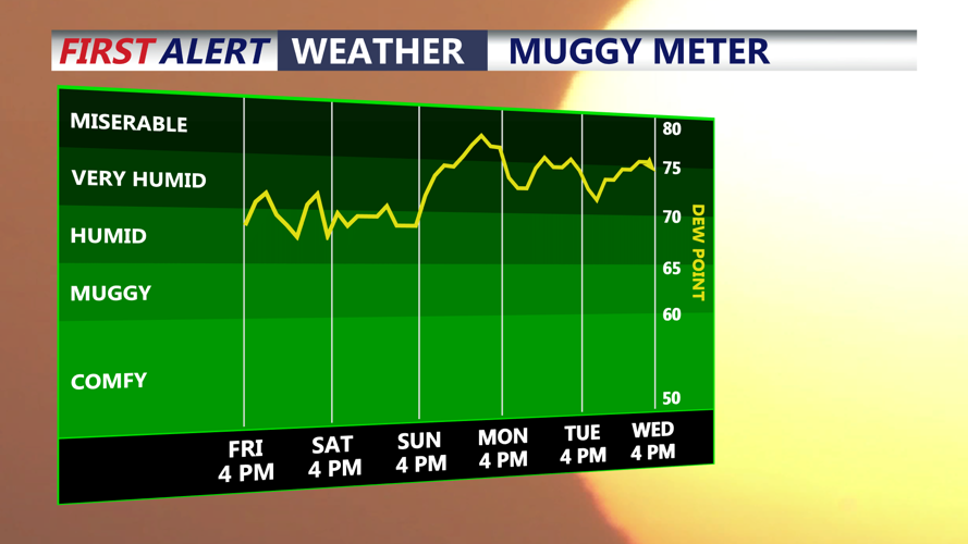
Friday is shaping up to be the pick of the week, featuring abundant sunshine, comfortable conditions and highs in the mid to upper 80s.

The weekend will turn warmer and gradually more humid. Partly sunny skies are expected Saturday and Sunday, with afternoon temperatures climbing into the upper 80s.

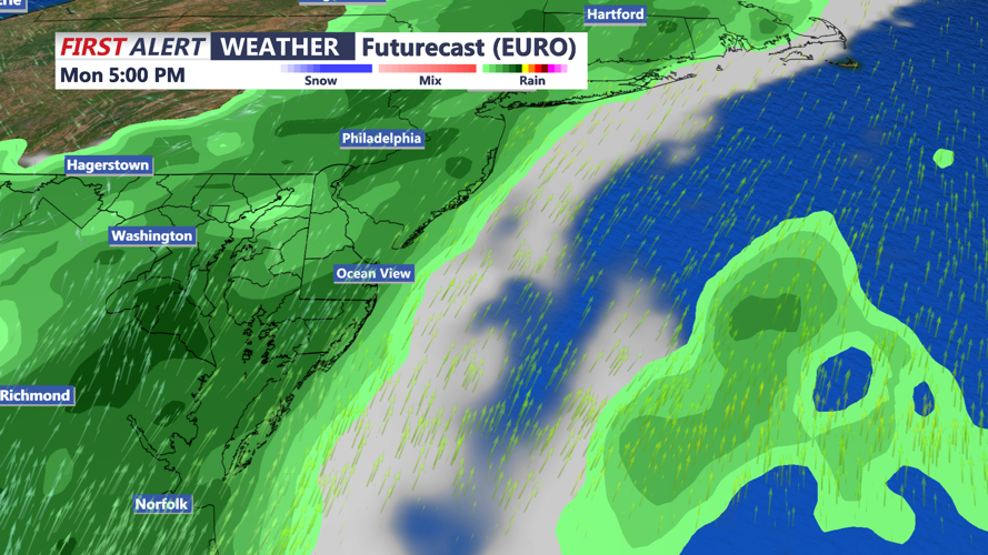
High pressure will weaken late Saturday as a developing storm system approaches from the Ohio Valley. Shower and thunderstorm chances may begin increasing Sunday afternoon, especially across western portions of Delmarva, before spreading across the peninsula Sunday night and Monday.

Deep tropical moisture will accompany the system, creating the potential for locally heavy rainfall. Atmospheric moisture levels may climb well above normal, raising concerns for flooding in areas that receive repeated thunderstorms.
Increasing humidity and instability may also support a risk of stronger storms Sunday and Monday afternoon. The primary concern currently appears to be heavy rainfall, but the severe weather threat will need to be monitored as the system approaches.
