


DELMARVA - The stretch of dangerous heat and humidity continues, with potentially record-challenging temperatures and a continued risk for strong to severe thunderstorms.

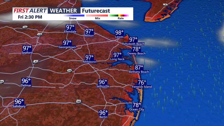
A mid-level ridge moving across the Mid-Atlantic and Northeast, combined with high pressure offshore of the Southeast coast, will keep a hot and humid air mass in place across Delmarva. High temperatures today are expected to climb into the low to mid 90s, a bit cooler at the coast. Todays record high is 95 degrees, set in 2017.
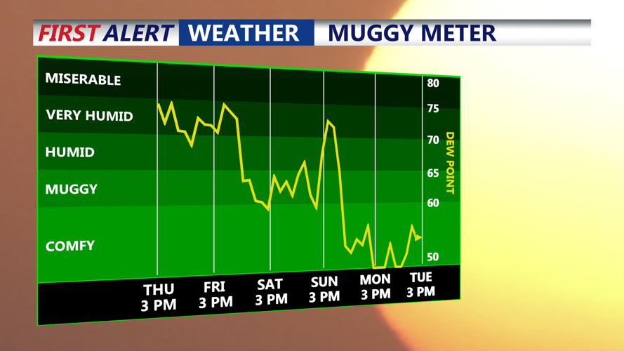
Dewpoints will begin in the low to mid 70s, making the air feel very humid. Afternoon mixing may lower dewpoints somewhat into the upper 60s and low 70s, but heat index values are still expected to peak between 95 and 105 degrees across much of Delmarva. This level of heat can become dangerous quickly, especially for sensitive individuals, those without reliable cooling, and anyone spending long periods of time outdoors.

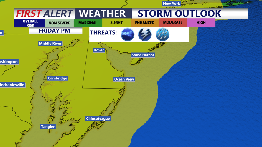
The threat for severe weather today is looking more widespread as a cold front approaches later today and tonight. The entire area is again highlighted in a Slight Risk, level 2 out of 5, for severe thunderstorms. Damaging winds will once again be the primary concern.

The cold front is expected to move through Delmarva later today, bringing some relief for the weekend. Temperatures will still be warm to hot, with highs generally in the upper 80s to mid 90s, but humidity levels will drop noticeably. Dewpoints may fall into the 50s in some areas Saturday, making conditions feel much more comfortable compared to today and Friday.

Another cold front is expected to move through late Sunday night, bringing a renewed chance for scattered showers and thunderstorms. This setup does not appear as favorable for severe weather because the front will arrive overnight, limiting instability. However, there should be enough moisture and forcing to support some needed rainfall.
Behind that front, a more seasonable air mass is expected to settle into Delmarva for Monday through Wednesday. Highs should range from the upper 70s to mid 80s, with overnight lows in the mid 50s to low 60s. Dewpoints in the 50s and low 60s will make for much more pleasant conditions through the middle of next week, with only a low chance for a stray shower.
