


DELMARVA -A cold front is sweeping away the humidity, but it remains hot for the start of the weekend.

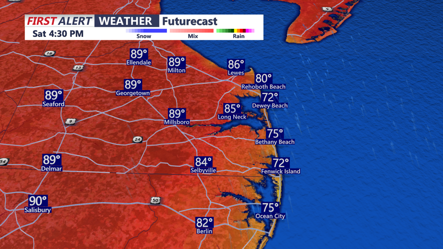
The weekend will still be warm, with highs generally in the upper 80s to low 90s, but dewpoints will fall to much more comfortable levels. Some areas may see dewpoints drop into the 50s on Saturday, making the heat index much less of a factor. Highs Sunday will be in the low 90s under mostly sunny skies.


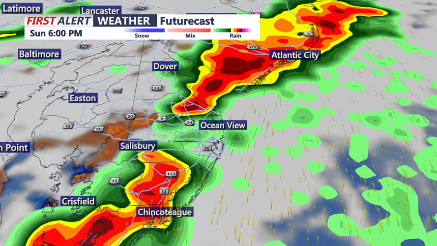
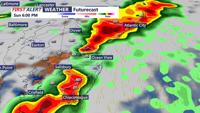
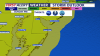
Another cold front will approach late Sunday into Sunday night, bringing renewed chances for scattered showers and thunderstorms. There is another slight risk, level 2 out of 5, for severe storms during that period. The severe weather threat will depend on how much moisture and instability can return before the front arrives. A slower front would allow a greater storm threat, while a faster front would likely limit the risk.

Behind that front, a more seasonable air mass will settle over Delmarva through the middle of next week. Highs Monday through Wednesday are expected to range from the mid 70s to mid 80s, with overnight lows in the 60s. Lower humidity will make conditions feel much more pleasant, and rain chances look generally low during that stretch. The next best chance for rain comes on Wednesday and Thursday, as temperatures warm from the 80s into the 90s.
