


DELMARVA - A moderating trend with temperatures above freezing is expected this week.

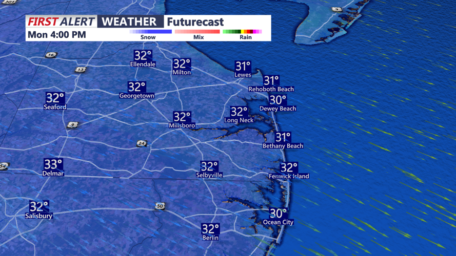
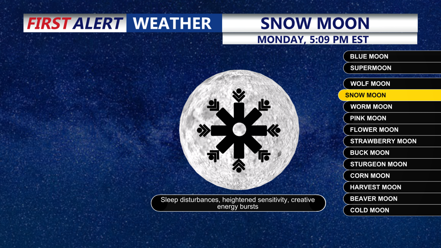
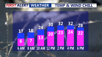
It's a cold start to our Monday with temperatures starting out in the low to mid teens with feels like temperatures in the zero to ten above range. Today, skies turn sunny but it stays blustery, and temperatures finally creep to near the freezing mark for the first time since last Sunday. We'll be treated to the second full moon of 2026, the snow moon this evening. Skies will be clear allowing for perfect viewing.

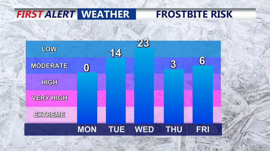
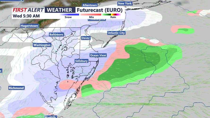
Temperatures moderate into mid to upper 30s on Tuesday and Wednesday before another blast of arctic air arrives late next week. The pattern stays active, with another opportunity to see snow and/or rain. Precipitation chances are in the 40-60 percent range. The exact track will matter a lot, because a farther south storm track would reduce snow chances here, but could also set up even colder conditions for Thursday and Friday. The second chance comes Friday night into Saturday morning, when an Alberta Clipper could bring a period of light snow. Confidence is low this far out, but current guidance supports a roughly 25 to 35 percent chance for snowfall with that system, and if upper-level features happen to align more closely, the end result could be more robust than currently advertised.

One additional complication is the ice already developing on local bays. Ice can be pushed onshore during high tide, and any flood water on roadways could freeze, creating icy travel hazards even after tides recede. If you’re in flood-prone coastal areas, be prepared for water on typically vulnerable roads and keep an eye on any water that may refreeze as temperatures remain well below normal.

Stay up to date on the changing weather conditions with radar and hourly forecasts in the CoastTV weather app, available for Apple and Android.
