


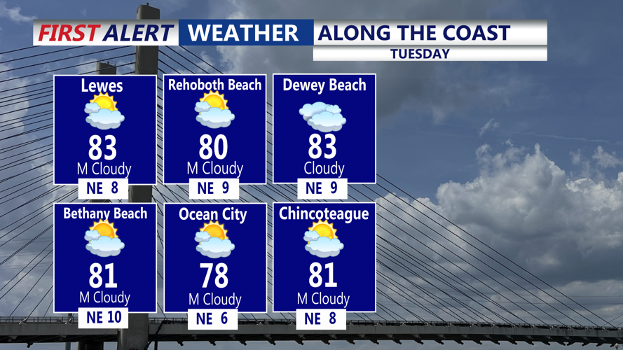

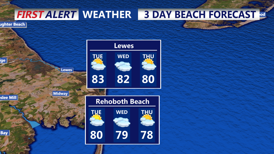


DELMARVA - High pressure to the north will remain the dominant influence on Sussex County’s weather from early Tuesday into early Thursday, creating an onshore breeze that keeps temperatures cooler than normal for early August. Early Tuesday morning will start mild, with lows in the 60s and patchy fog possible in sheltered areas. As the day progresses, skies will feature a mix of sun and high clouds, with inland highs reaching the mid-80s and coastal areas near 80 degrees. Humidity will be slightly elevated compared to recent days but still comfortable overall.
Tuesday night will remain mild as the east to northeast breeze continues. Overnight temperatures will hold in the mid-60s to around 70 degrees under partly cloudy skies. By Wednesday, high pressure strengthening over New England will reinforce the onshore flow, resulting in highs mainly in the low to mid-80s, cooler than seasonal averages. Dew points will tick upward slightly, making it feel more humid, but most of the day will remain dry. There is only a small chance of a light inland shower during the afternoon, with most areas staying dry.
Early Thursday morning will bring another mild start, with temperatures in the 60s under partly cloudy skies and a light breeze. Conditions will remain stable and largely dry heading into the day.
