


DELMARVA - High pressure will remain the dominant weather feature across Sussex County through late Wednesday, keeping skies mostly clear and conditions dry. Overnight lows will fall into the upper 40s to upper 50s under calm, cool skies.
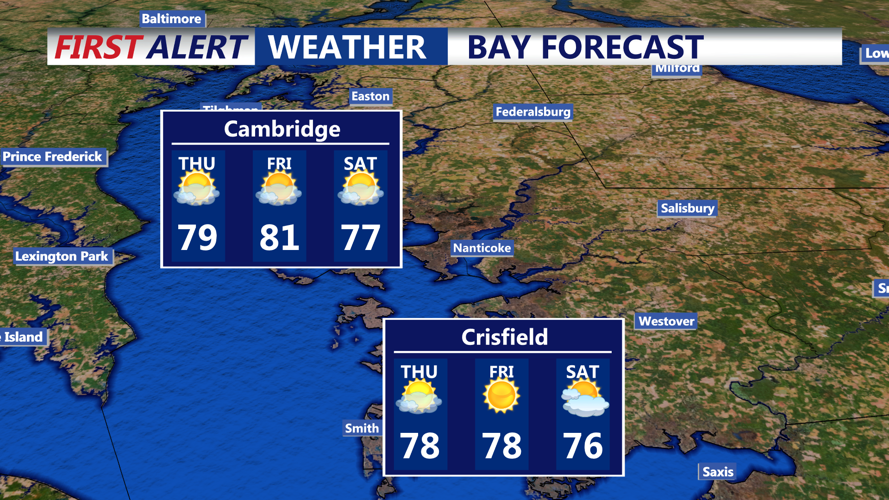
On Thursday, an upper-level trough will linger across the Northeast with a weak disturbance passing through. While high pressure will continue to hold at the surface, this disturbance could generate a few light, spotty showers during the day. However, rainfall is expected to be minimal, with highs climbing into the 70s under partly cloudy skies.
By Thursday night, a stronger upper-level trough will begin to amplify across the Mid-Atlantic and Northeast, bringing a cold front toward the region. A few showers may develop late Thursday night into early Friday, mainly west of the county, though moisture remains limited.
Friday will feature the passage of the cold front, accompanied by cooler temperatures and another chance for isolated showers. With the strongest energy and moisture lifting north of Delaware, rain chances will remain low, at about 20 to 30 percent, mainly across northern and eastern areas. Daytime highs will run below seasonal averages, and dew points will briefly rise into the 50s before dropping again by late Friday.
Behind the front, conditions will clear Friday night as high pressure returns, setting up a dry and cooler start to the weekend with partly cloudy skies.
