


DELMARVA - Watch for areas of dense fog out the door this morning. Visibility could be less than a mile at times. Otherwise the fog lifts mid-morning with a mix of sun and clouds.

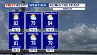
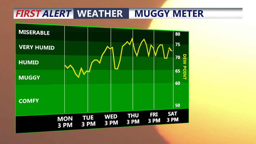
We begin a warm up to start the week, but this will feel cool compared to what's coming our way later in the week. Expect a mix of sun and clouds Monday and Tuesday, with highs in the low 80s Monday, with upper 80s for Tuesday. It will remain on the muggy side. Lows at night in the 60s.

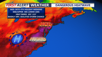
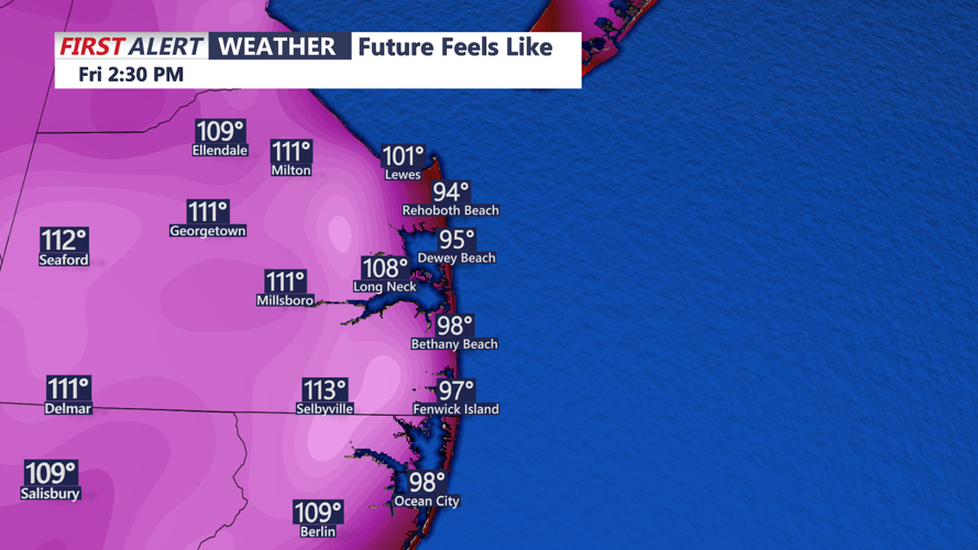
Looking ahead, dangerous heat is expected to build into Delmarva by the middle and end of next week. Highs will be in the mid 90s beginning as early as Wednesday, with temperatures in the lower 100s both Thursday and Friday. Heat index values will be in the 104-114 range. This heat could be dangerous for some groups.


As of now, the Fourth of July holiday weekend begins very hot, with highs in the upper 90s to near 100, and high humidity to go with it on the Fourth. Heat indices will still be in the 102-112 range. A few isolated storms are possible, but a washout isn't anticipated at this point. The cookouts and fireworks look dry at this time. Slight cooler Sunday with highs in the mid 90s, as the dangerous heat starts to subside.
