


DELMARVA- We'll see our weather going downhill as we go into Saturday evening and night as a coastal low starts to head our way. The peak of the system occurs on Sunday with the strongest winds and heaviest rain.

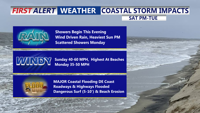
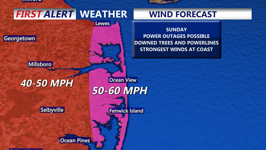
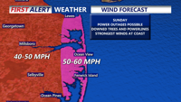
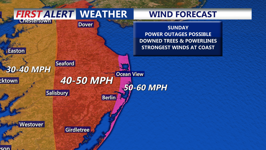
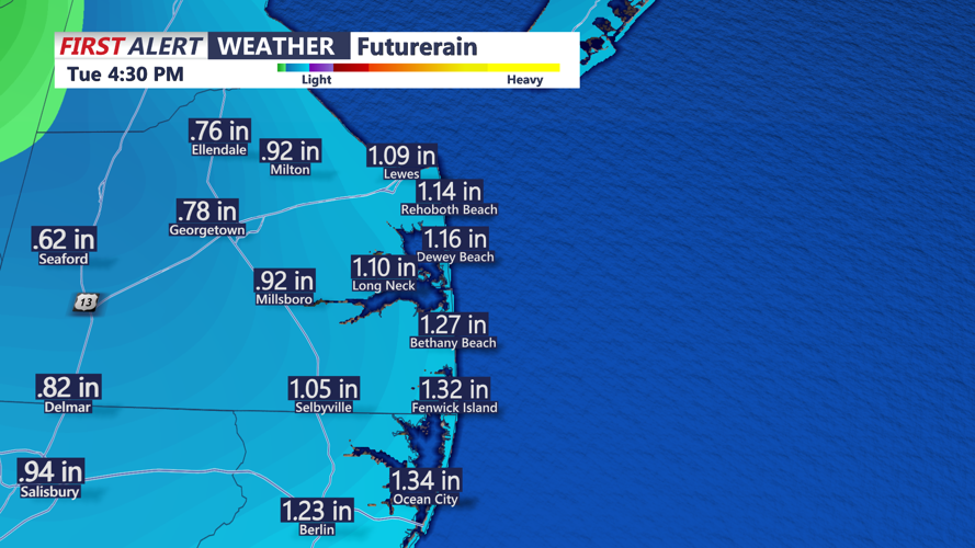
At this point it's not one strong area of low pressure, instead it's an elongated area of low pressure. We'll see some major impacts especially at the coast. Rain begins later tonight into Sunday morning, and it could be heavy at times. The winds ramp up as well overnight into Sunday. We'll see gusts over 50 mph at the coast with slightly lower gusts inland. Lows overnight in the low 60s.


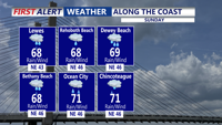
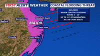
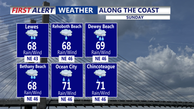
The water will pile up causing coastal flooding on Sunday, with inundation of 1-2 feet in vulnerable spots. If you live in a flood prone area, make sure to make proper preparations. Power outages are possible through Sunday as wind gusts could reach close to 60 mph the coast with 40-50 mph gusts farther inland. Highs in the upper 60s Sunday.

Sunday night we'll see the rain and strong winds continue, with gusts still over 50 mph at the coast, with coastal flooding possible, especially at time of high tides. lows in the 50s to around 60.

Monday, conditions won't be as intense. However we'll still see areas of rain and gusty winds continuing. Highs in the mid 60s are expected.
The rain tapers off Monday night with diminishing winds, with lows in the mid 50s.
We're still looking at a lot of clouds on Tuesday with a slight chance for showers and remaining breezy, with highs in the 60s.
The sun finally reappears Wednesday with a mix of sun and clouds and temperatures near 70. However, cooler weather is expected for Thursday and Friday with highs in the low 60s and lows in the 40s.
Check out the storm on live radar by using the Coast TV Weather App for Android and Apple devices.
https://play.google.com/store/apps/details?id=com.wboc.android.weather&hl=en_US
