




DELMARVA- A brief break from wet weather is expected this afternoon, as high pressure builds in from the Midwest. The breezy conditions continue under partly cloudy skies. Highs will be in the upper 40s and low 50s. It will feel colder with the wind.
Friday night will be mainly clear and cold with lows in the upper 20s and low 30s.

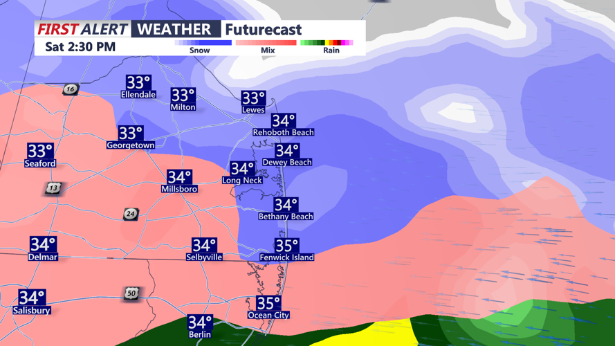
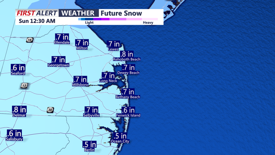
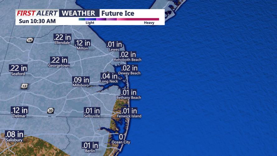
The next low-pressure system will quickly move in by Saturday. A wintry mix is expected. The precipitation could start as snow, then change to a period of sleet and freezing rain. Up to an inch of snow is possible, with some accumulating sleet expected too. Temperatures slowly climb through the 30s Saturday evening with plain rain expected. Rain chances decrease on early Sunday morning with temperatures in the 30s and 40s.


Sunday will be partly cloudy with temperatures in the 40s. Sunday night will be dry and cold with lows in the 20s and 30s.
Monday expect skies to become cloudy throughout the day with highs in the low 40s.

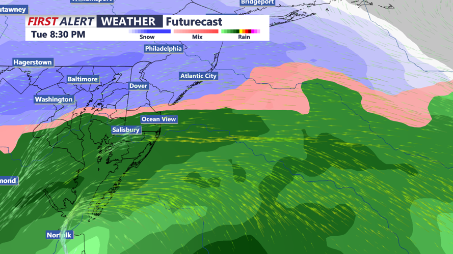
Another system will take aim on Delmarva Tuesday. Snow could develop in the afternoon, with a changeover to rain in the evening. It's still too soon to tell if the system with produce more snow than rain, or the other way around.
We'll keep you posted!
