


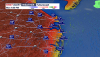

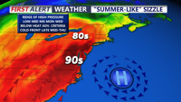


DELMARVA - A much warmer pattern is taking over across Delmarva that will continue into the middle of next week. An upper-level ridge will build into the Eastern United States, while high pressure settles over the western Atlantic just off the Mid-Atlantic coast. This setup will bring a warm south to southwesterly flow, gradually pushing temperatures higher each day.
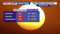
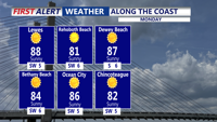
Tonight expect partly cloudy skies and mild temperatures with readings primarily in the mid 60s. The heat will continue to build Monday through Wednesday. Many inland areas of Delmarva could reach the upper 80s to low 90s Monday, with some spots potentially climbing into the mid 90s Tuesday or Wednesday. Temperatures may approach record high territory during this stretch, though humidity levels are not expected to become especially oppressive early in the week. Overnight lows will be in the 60s to around 70.
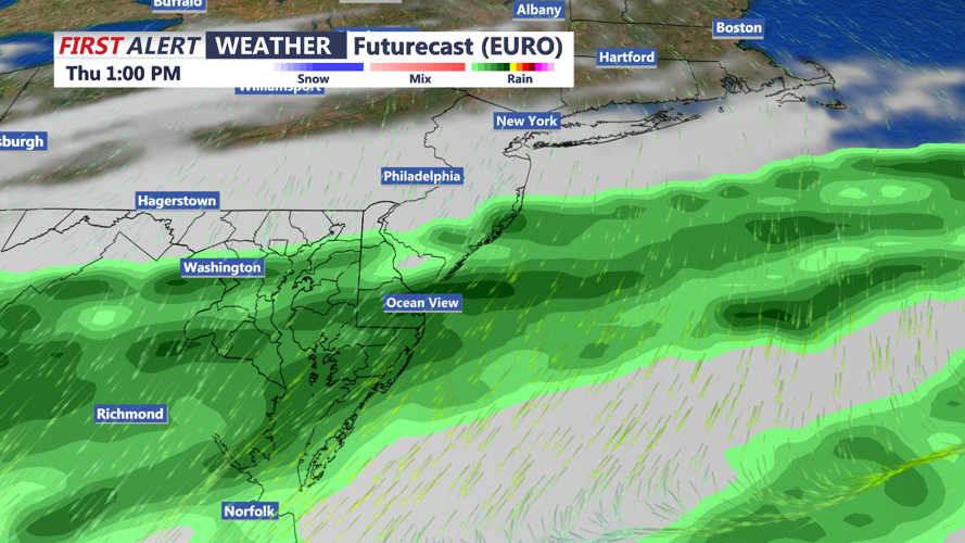
A cold front is expected to approach late Wednesday, bringing a better chance for showers and thunderstorms into Thursday. That front should also bring an end to the stretch of above-normal temperatures. Showers could linger off and on into the upcoming holiday weekend with cooler temperatures.
