


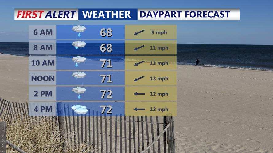


DELMARVA - Tuesday starts with persistent onshore winds and mostly cloudy skies across the Delmarva coast. Temperatures stay on the cooler side, topping out in the low to mid-70s, as high pressure remains to the north and a stalled boundary lingers to the south. Some patchy drizzle and light showers may brush the beaches, and coastal areas will remain damp and breezy. Overnight lows dip into the 60s with patchy fog possible as moist air holds in place.
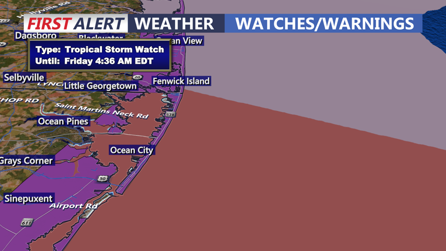
A Tropical Storm Watch is now up for Fenwick Island, Ocean City and Assateague to Chincoteague for Wednesday evening through Thursday evening.
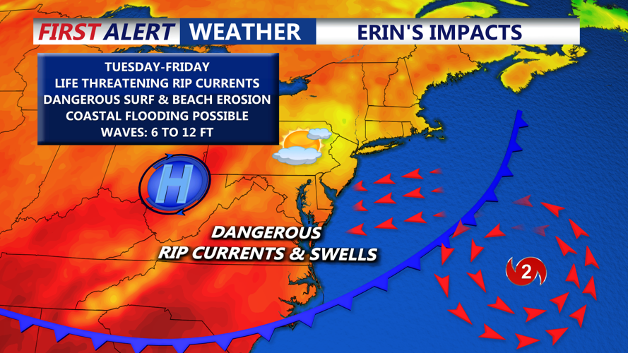
By Wednesday, conditions turn more unsettled. A passing trough brings scattered light showers across Sussex County and Ocean City, though rainfall will not be widespread or heavy. The main story will be the increasing influence of Hurricane Erin as it makes its closest pass offshore. Winds from the northeast strengthen, seas rise sharply and surf becomes hazardous. Rip currents will be strong and persistent, and waves could reach eight feet along the shoreline. Offshore seas build to as high as 15 feet, making conditions dangerous for boaters as well.
Coastal flooding becomes a real concern Wednesday into Thursday as Erin enhances the onshore flow. Tidal flooding of up to a foot is possible in the most vulnerable bayside and low-lying areas. Some local roads near the water may briefly close at times of high tide. Beach erosion is also expected, particularly along exposed stretches of the Delaware and Maryland coastline. Winds at the immediate shore could gust up to 35 mph, adding to the hazards.
By Thursday, Erin begins to move farther out into the Atlantic, but the coast will still feel the impacts. Surf remains rough, rip currents remain dangerous, and coastal flooding may linger, even as skies start to clear inland. Temperatures moderate slightly into the upper 70s and low 80s, offering a taste of improving weather once the storm fully exits late in the week.