


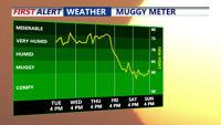


DELMARVA - The hot and muggy weather continues through early Thursday, as rising heat and stagnant air create uncomfortable, and at times, unhealthy conditions.

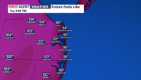
This afternoon under hazy sunshine, temperatures surge into the low to mid 90s, with dew point temperatures in the 70s. The combination will create feels like temperatures in the 100-105 range.

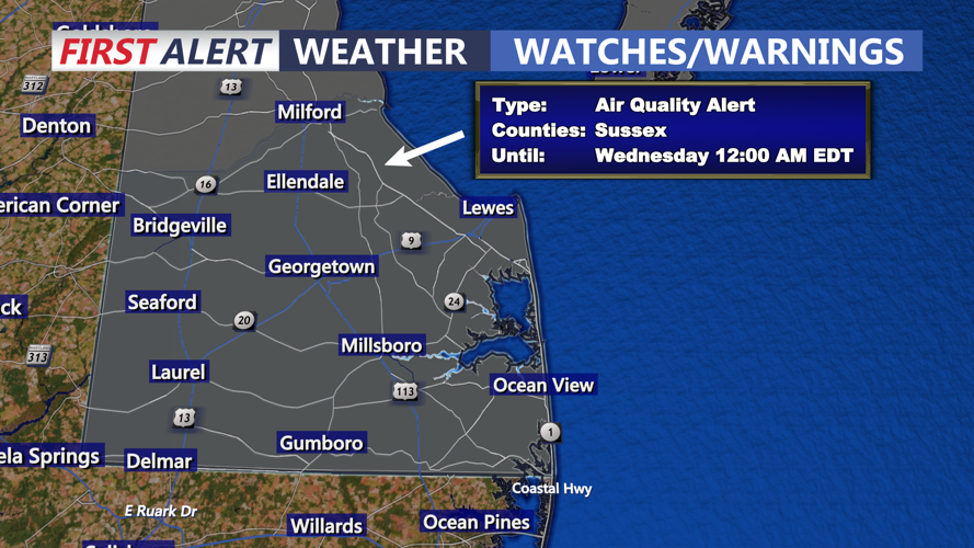
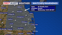
With light winds and stagnant air, ozone levels are expected to climb, prompting a Code Orange air quality alert for Sussex County the rest of today. Sensitive groups, including children, older adults and individuals with respiratory conditions are urged to limit strenuous outdoor activity.

Tuesday night will remain warm and sticky, with lows only dipping into the 70s. This sets the stage for another steamy day Wednesday, when highs will again reach the upper 80s and 90s. Humidity levels will stay elevated, continuing the muggy feel and potential for discomfort during outdoor activities.

By Wednesday evening into early Thursday, skies will be partly cloudy with a slight chance for an isolated thunderstorm, mainly inland where daytime heating triggers instability. Overnight lows remain mild, generally in the upper 60s to low 70s. The overall pattern shows little change through Thursday morning, with warm, humid air persisting across the region and another day of moderate to unhealthy air quality possible for parts of Delmarva.

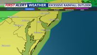
The weather becomes more active later Thursday into Friday as a slow moving cold front moves towards the region. Heavier showers and storms will develop across Delmarva with some locally heavy rain possible.