



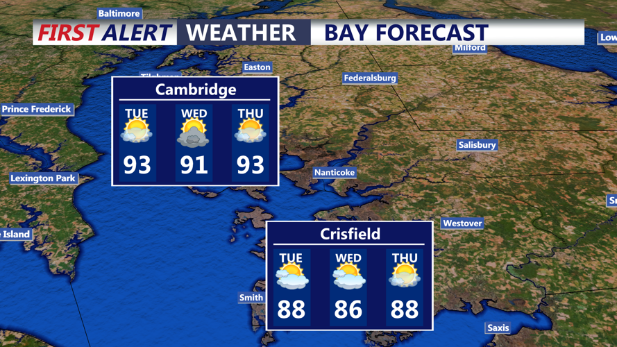

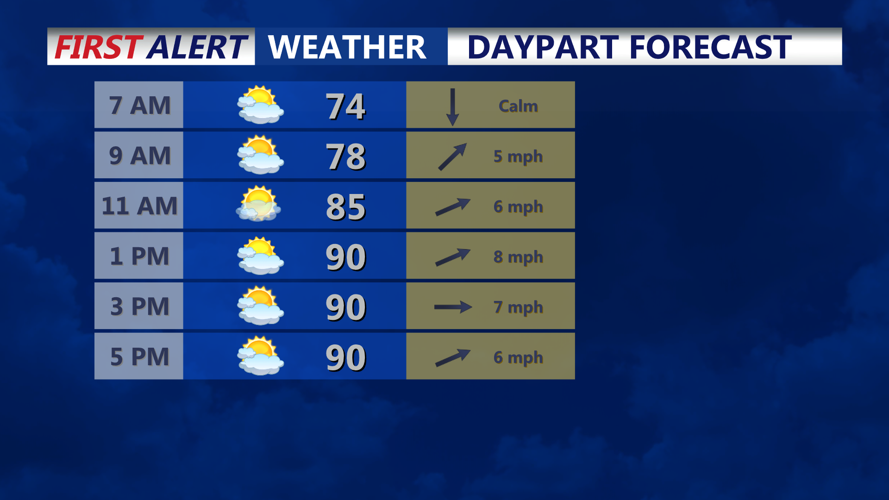

DELMARVA - A hot and increasingly humid Tuesday is expected across as temperatures climb into the lower to middle 90s and the risk of thunderstorms increases later in the day.
Tuesday morning should begin warm and muggy, with temperatures rising quickly under partly cloudy skies. Dew points in the upper 60s to lower 70s will make conditions feel increasingly uncomfortable by midday.
Afternoon highs could reach the lower to middle 90s across inland, with slightly cooler conditions near the beaches. Heat index values are expected to climb well into the 90s and could approach 100 degrees in some areas.
Attention will then turn to the potential for strong to severe thunderstorms Tuesday afternoon and evening. Sussex County is within a broader Slight Risk, or level 2 out of 5, for severe weather.
The atmospheric setup could support storms capable of producing damaging wind gusts and large hail. An isolated tornado also cannot be ruled out, although the exact timing and coverage of the strongest storms remain uncertain.
Heavy rainfall will be another concern. High moisture levels in the atmosphere could allow thunderstorms to produce torrential downpours, and repeated storms could lead to localized flash flooding, particularly in areas that have received significant rainfall recently.
Storms could continue through Tuesday evening and into portions of Tuesday night before becoming more scattered overnight. Conditions will remain humid, with overnight lows generally in the upper 60s to lower 70s.
By early Wednesday morning, a frontal boundary will remain near the region, keeping the atmosphere unsettled. Additional showers and thunderstorms will remain possible later Wednesday as the active weather pattern continues.
The period from Tuesday through Thursday remains favorable for multiple rounds of thunderstorms, with additional severe weather and flooding concerns possible.
