


DELMARVA - A much-needed break from the oppressive heat is on the way. After a day marked by heat indices between 100 and 105 degrees, a weak cold front will push through the region Thursday evening. The front may trigger isolated showers and thunderstorms, mainly between 4 p.m. and 10 p.m. While the atmospheric setup includes high instability, other storm-supporting factors like wind shear and lapse rates are limited. As a result, the severe threat is marginal, with damaging wind gusts being the main concern in any stronger cells.
Thursday Night:
Behind the front, more comfortable air filters in with rapidly falling dew points. Temperatures overnight will drop into the upper 60s to mid-70s, with the Poconos possibly dipping into the 50s. Skies will gradually clear for most areas, though clouds may linger in far southern Delaware and southern New Jersey.
Friday Outlook:
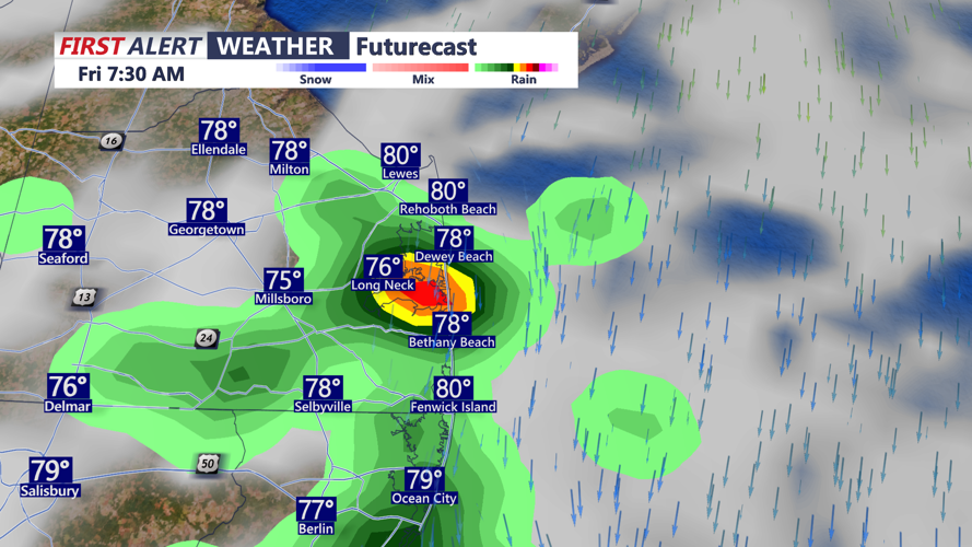
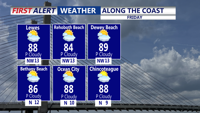
The cold front is expected to stall just to our south and east by morning, keeping the chance of clouds and an isolated shower or thunderstorm alive across Delmarva and southern New Jersey. Elsewhere, Friday should be dry and much more pleasant, with dew points in the 50s and 60s. Temperatures will also ease back to more seasonable levels, topping out in the low to mid-80s.
Friday Night Preview:
Some clouds and possibly a stray shower could persist into Friday night, especially across Delmarva. Otherwise, expect lows in the mid to upper 60s, and upper 50s in the cooler interior areas such as the Poconos.
