


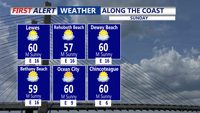


DELMARVA - This afternoon will be cool and breezy with highs in the mid 60s inland, and 50s and 60s at the coast. Tonight, as a southerly breeze develops, clouds increase a bit and temperatures will be a bit milder, in the low to mid 50s.
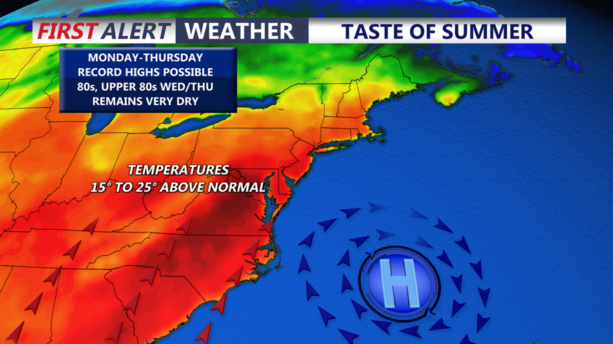
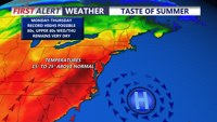
The bigger story arrives early next week as a significant warming trend takes hold across Delmarva. High pressure will briefly build in behind the weekend front, then shift east and allow a prolonged return flow to set up. That pattern will send temperatures steadily upward, with highs climbing well into the 80s by the middle of next week. In the typical hotter spots, 90 degrees cannot be ruled out. The record high in Georgetown for Wednesday is 86, then 89 for Thursday. Overnight lows will also turn much milder, only falling into the 60s.
By Wednesday, record highs could be in jeopardy. A few weak disturbances may pass to the north late Monday, but overall the forecast stays dry through much of the week. The next meaningful cold front may not arrive until Friday or Saturday, allowing the warm spell to hold on for several days across the peninsula.
