


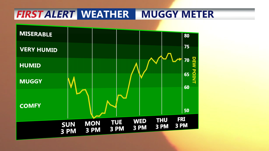
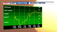

DELMARVA - Overnight will be muggier with lows in the upper 60s to low 70s. Showers and thunderstorms may develop in a few spots, though most of that activity is expected to remain north and west of Delmarva, potentially impacting New Castle County/I-95 Corridor with a gusty thunderstorm.

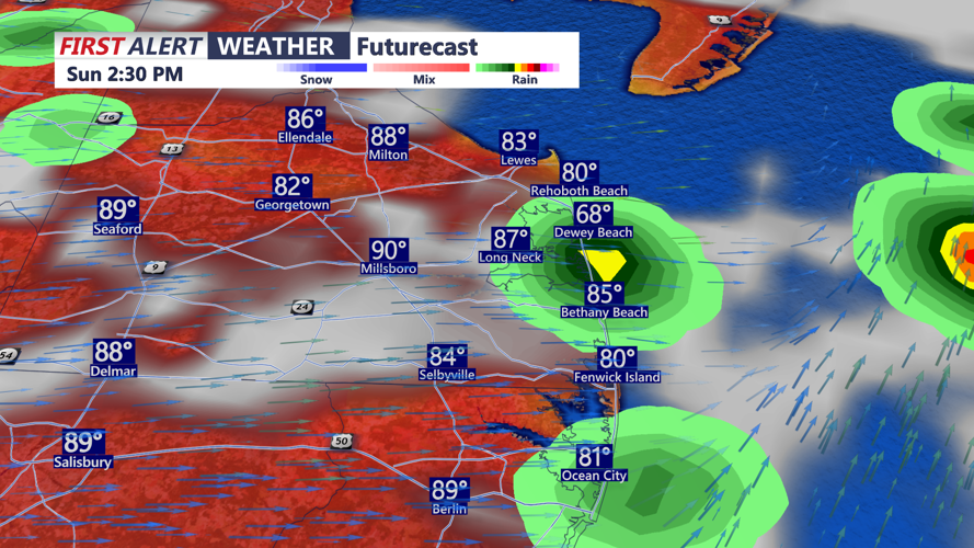
A cold front will sweep through on Sunday, helping to break the heat. Highs will still reach the low 90s, and it will remain muggy. A few isolated gusty thunderstorms are possible, for the southern portion of Delmarva. The main threat with any stronger storms will be damaging winds.

Behind the front, high pressure builds in from the north early next week. That will bring briefly cooler temperatures, with highs in the 70s and 80s to start the week. Mainly dry weather is expected through much of next week, with temperatures gradually warming again as high pressure slides offshore and southerly flow returns.


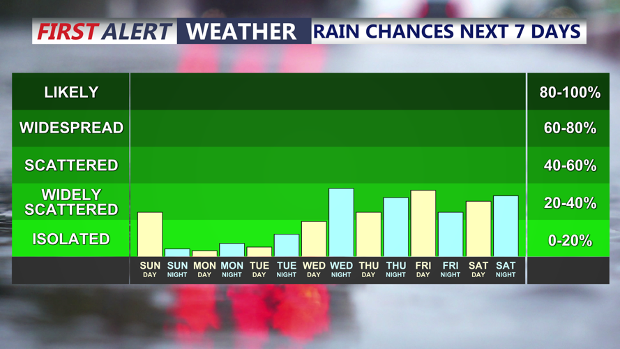
The main forecast concern for the second half of next week will be another stretch of above normal heat, however, isolated to scattered showers and storms develop Thursday and continue into the weekend, bringing a little relief to the drought conditions.
