



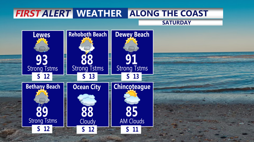
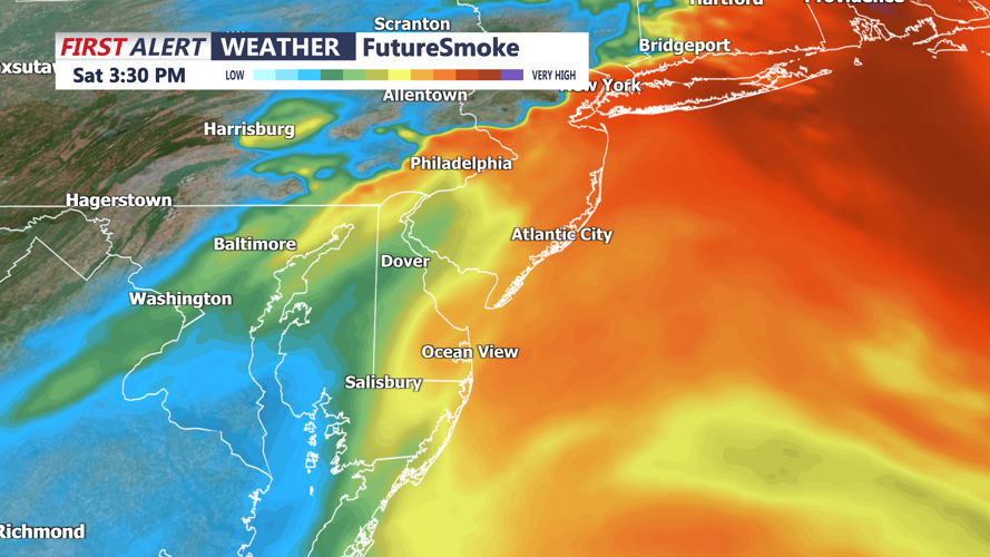

DELMARVA - The dense wildfire smoke will move out this morning as humid air moves across Delmarva. A few showers or thunderstorms could arrive this morning as a warm front lifts through the region, although southern portions of the peninsula may miss much of this initial round. During that period, temperatures will climb into the upper 80s and lower 90s while humidity levels increase sharply.

The combination of heat and moisture could produce heat index values near 100 degrees, with some portions of Delmarva feeling as hot as 105. Anyone attending outdoor events should take frequent breaks, drink water and closely monitor changing weather conditions.

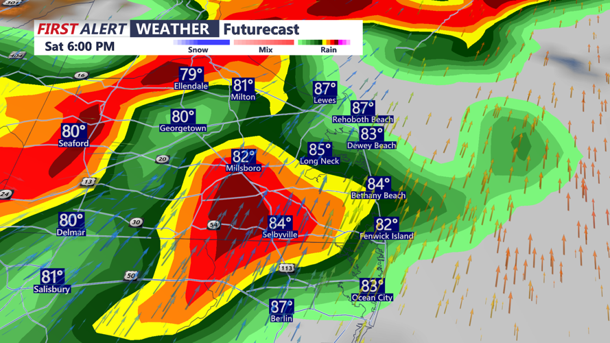
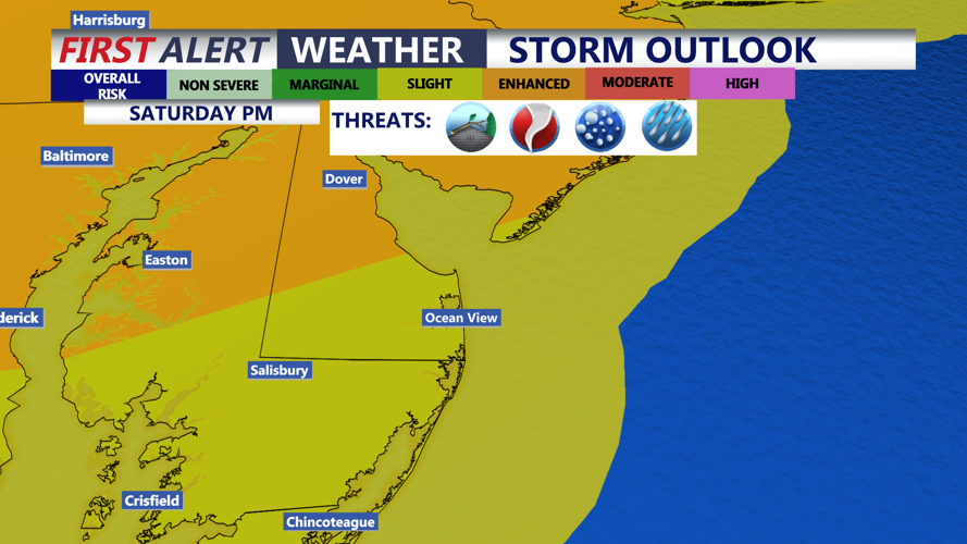
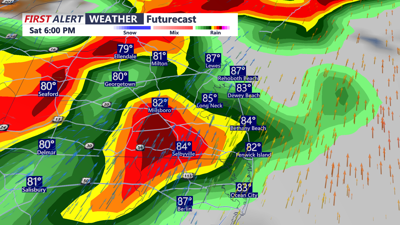
A more widespread and potentially dangerous round of thunderstorms is expected to develop from the middle or latter part of Saturday afternoon into Saturday evening. Storm Prediction Center has a SLIGHT risk (2 of 5) for the threat of severe storms.

The strongest storms could produce damaging wind gusts and large hail. A few rotating storms may also develop, increasing the potential for isolated supercells with a tornado threat. Very high atmospheric moisture will also support torrential rainfall. Some thunderstorms could produce rainfall rates exceeding 2 inches per hour, creating a risk of flash flooding. Thunderstorms should gradually weaken late Saturday evening and overnight as a cold front crosses Delmarva.
Sunday is expected to be much quieter, with mainly dry weather, seasonable temperatures and more comfortable humidity. A lingering shower or thunderstorm cannot be ruled out across southern Delaware and portions of Maryland’s Eastern Shore, but most communities should remain dry.
Monday looks dry and seasonable with temperatures in the mid 80s. Another front will move through Tuesday -Wednesday bringing a threat of scattered showers and storms. Temperatures fall slightly below average late week.
