


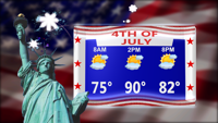


DELMARVA - High pressure will continue to move offshore into Independence Day as a surface low and associated upper-level trough move eastward through eastern Canada. This will push a warm front through the region early in the day Thursday, allowing Delmarva to get into the warm sector. The warm front could bring a few isolated showers or storms early Thursday morning, but the greater chances for showers and storms will arrive later in the day.
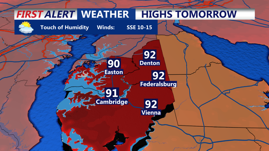
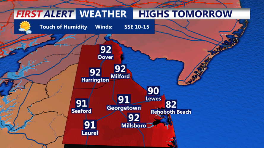
Prior to this, the return of the heat and humidity will be the main story. Highs for most areas will reach the upper 80s to low 90s, with cooler temperatures near the coast. Dew points will climb to the upper 60s to low 70s, resulting in maximum heat indices in the 90s for most areas. Cloud cover is expected to increase as the day progresses, and winds will be from the south to southwest at 5-10 mph, with stronger gusts of 15-20 mph near the coast.
As for the storm threat later in the day, expect storms to develop along a weakening frontal boundary over Pennsylvania by the afternoon, moving eastward into Delmarva by the evening. This means showers and thunderstorms could potentially affect Delmarva and southern coastal areas, possibly interfering with Independence Day festivities.
While it won't be an all-day rain event, residents should be prepared for the possibility of evening disruptions due to the weather.
