


DELMARVA - It was absolutely picture-perfect weather across the peninsula earlier today. Afternoon highs reaching the upper 70s to low 80s inland and the low 70s along the coast.
Tonight expect another cool one, under clear skies and light winds. Lows in the low 50s inland, a bit warmer at the coast.
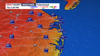
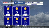
High pressure will keep Delmarva dry through the end of the week. For Thursday, wall-to-wall sunshine returns, and temperatures will climb even higher. Inland communities can expect highs in the mid to upper 80s, while the beaches stay in the mid to upper 70s.
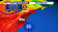
The warming trend continues Friday and Saturday, with inland temperatures reaching near or into the low 90s. Shore areas will remain cooler, with highs generally in the 80s. Humidity will also begin to increase heading into the weekend.
By late Saturday night into Sunday, changes arrive across Delmarva. A trough moving in from the northwest will help bring a cooler and more unsettled pattern. Showers may become possible Saturday night, with a thunderstorm also possible.
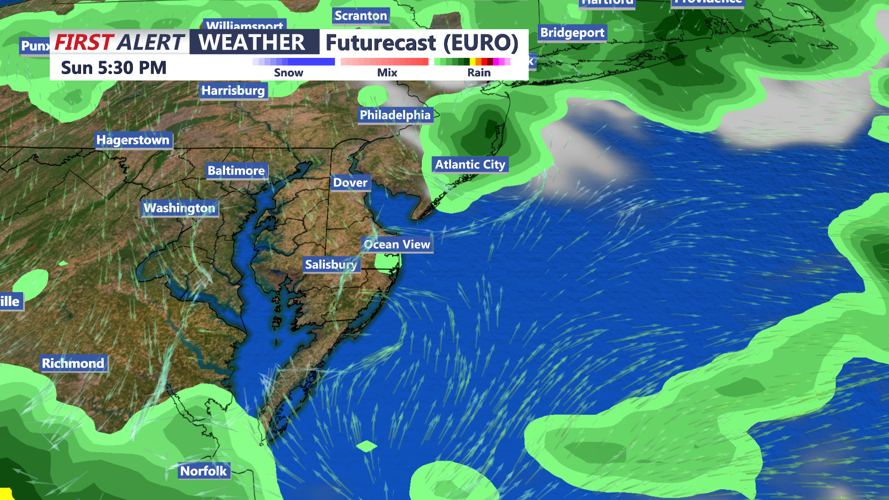
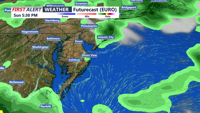
The best chance for rain comes Sunday, when scattered showers and thunderstorms are possible as a cold front moves southward across the region. Depending on timing and how the atmosphere develops, an isolated stronger to severe thunderstorm cannot be ruled out.
Cooler weather is expected into Monday, with a few lingering showers possible, especially farther south as the front remains near Delmarva.
