


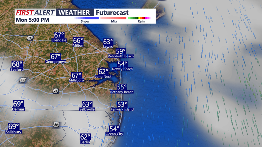


DELMARVA -- Enjoy a warm start to the week as a warm front lifts north of the region early Monday. Thanks to mid-and upper-level ridging ahead of a cold front, temperatures will rise into the upper 60s to low 70s across much of the area. Cooler 50s and 60s at the beaches. The day will remain dry as the region sits between two low-pressure systems.

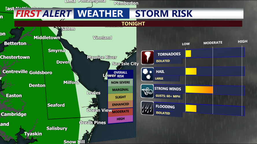
After sunset, a cold front approaching from the west will bring a round of showers and possibly a few thunderstorms. While the Storm Prediction Center has placed most of Delmarva under a general thunderstorm risk, portions of Kent, Queen Anne’s, Talbot, and a part of Sussex counties are now under a Marginal Risk for severe weather. The primary threat is damaging winds, though the potential remains low due to limited instability and a strong surface inversion overnight.

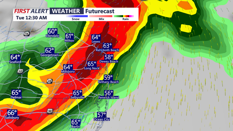
The rain event is expected to be brief, with most precipitation falling within a six-hour window. Rainfall totals will range from 0.10 to 0.25 inches. Overnight lows will settle into the 50s.

By Tuesday morning, the cold front will be offshore, and Delmarva will be under the influence of an upper-level trough and cyclonic flow. A few scattered showers may linger, especially near the coast in the morning. Gusty northwest winds up to 30 mph will develop during the afternoon, bringing in cooler air. Highs will reach the upper 50s to mid 60s.
A secondary cold front will sweep through late Tuesday night, though it will pass through dry. This front will usher in even cooler and drier air heading into midweek. Lows will be in the 40s and 50s.
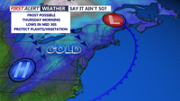
High pressure will settle in across the Eastern U.S., providing dry conditions and mostly sunny skies. Temperatures will remain seasonably cool on Wednesday with highs only in the mid to upper 50s. Overnight lows on both Wednesday and Thursday could dip into the 30s, raising the potential for frost or freeze concerns in areas where the growing season has begun.

Daytime highs will gradually moderate into the upper 50s to low 60s by Thursday, climbing further into the mid to upper 60s by Friday.
Temperatures will rise well into the 70s on Saturday under mostly cloudy skies, likely the warmest day of the week. Conditions should improve for Easter Sunday, which currently looks dry with highs in the 60s.