


DELMARVA- Arctic air will continue to build into Delmarva the next few days with rounds of snow on the way. The first round comes Friday evening with a dusting possible, then a more significant system for Monday.
For Thursday afternoon expect breezy and cold conditions, with gusts around 30 to 35 mph. Highs will range from the 30s to low 40s under sunny skies. The region will get a brief respite from the strong pressure gradient as high pressure moves closer from the southwest.

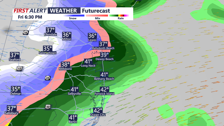
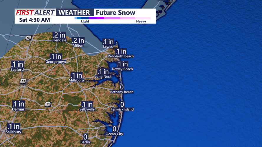
Heading into Friday, a weak low-pressure system will move through the Mid-Atlantic, bringing limited precipitation and a cold front. Rain showers later in the day will change to a period of snow by evening. A coating of accumulation is possible. Watch for slick roads.

By the weekend, high pressure will dominate, ensuring mostly dry conditions and chilly temperatures with highs in the 30s both days.
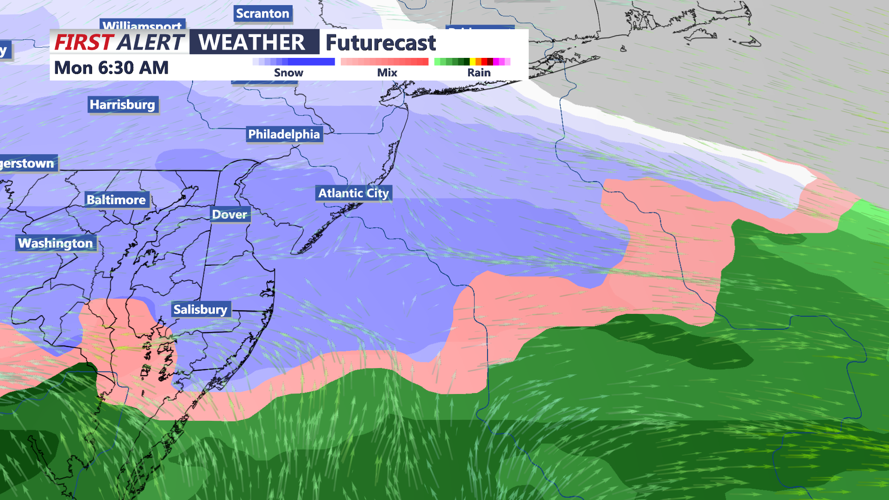
The real weather story arrives late Sunday into Monday as a robust low-pressure system tracks into the Mid-Atlantic. While exact snowfall amounts and storm intensity remain uncertain, this setup has the potential to deliver significant snow across parts of the region. You're encouraged to monitor the forecast as details emerge over the coming days. We could see at least 6 inches of snow for many of us into Monday.
