


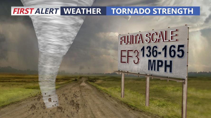

SUSSEX COUNTY, Del. - The National Weather Service confirms Saturday's storm was an EF-3 tornado.
This is Delaware's first EF-3 tornado since 1961. The most severe a tornado can be is an EF-5. The National Weather service says Saturday's tornado was 14.3 miles long, with peak winds of 140 mph. It was 0.4 miles, or 700 yards, wide.
According to the service, the tornado touched down at 5:59 p.m. near the intersection of Polk and Dublin Hill roads in Bridgeville and officially dissipated at 6:19 p.m. in Ellendale.
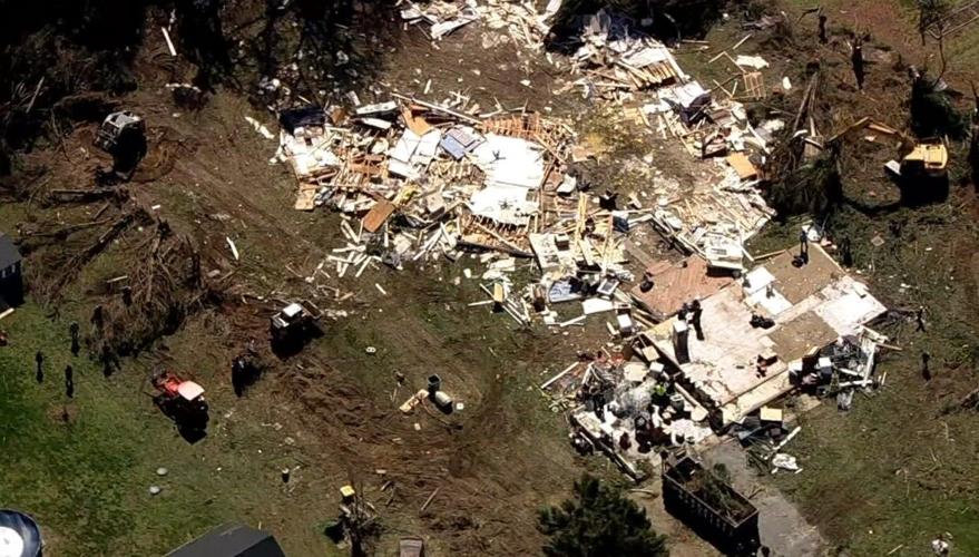
The National Weather Service says the storm destroyed roofs, blew out windows, downed power lines, uprooted and toppled several trees, and damaged a DelDOT facility. Above all else, the weather service report says the storm was so strong it caused some houses to slide off their foundations. The damage to residential structures is what killed Daniel Bawel. As the storm moved east, it weakened but caused tree and roof damage in Ellendale.
This was the most intense tornado ever reported in Sussex County. According to the National Weather Service, the strongest tornado on record in Delaware struck New Castle County on April 28, 1961. The longest track tornado on record in Delaware struck Kent and New Castle counties on June 7, 1988, which traveled 23 miles.
Saturday's storm is now the widest on state record. The two widest tornadoes previously on record in Delaware were the EF-2 tornadoes which hit on August 4, 2020 during Tropical Storm Isaias, both of which had widths of 500 yards.
In a release, the National Weather Service noted how abnormal this tornado and recent weather history is.
"Historically, Delaware has gone multiple years without any tornadoes, only to then have multiple occur in a short time," the report read. "There were no tornadoes for about a seven year period between September 28, 2004 and August 27, 2011. Delaware had five tornadoes in a single day during Tropical Storm Isaias, the most daily on record. The most in a year were six in 1992 and 2020."
For in-depth tornado coverage, click here.
