

DELMARVA - Tropical Storm Ophelia continues to strengthen and is now a 70 mile per hour tropical storm as it approaches the North Carolina Coast.
This does not bring any forecast changes at this time. The brunt of the storm is likely to come Friday after 10 p.m. and last until mid-afternoon Saturday morning. Rain will likely linger into Sunday.
Rain and wind have already increased here along the coast. The rainfall intensity will increase overnight into Saturday morning.

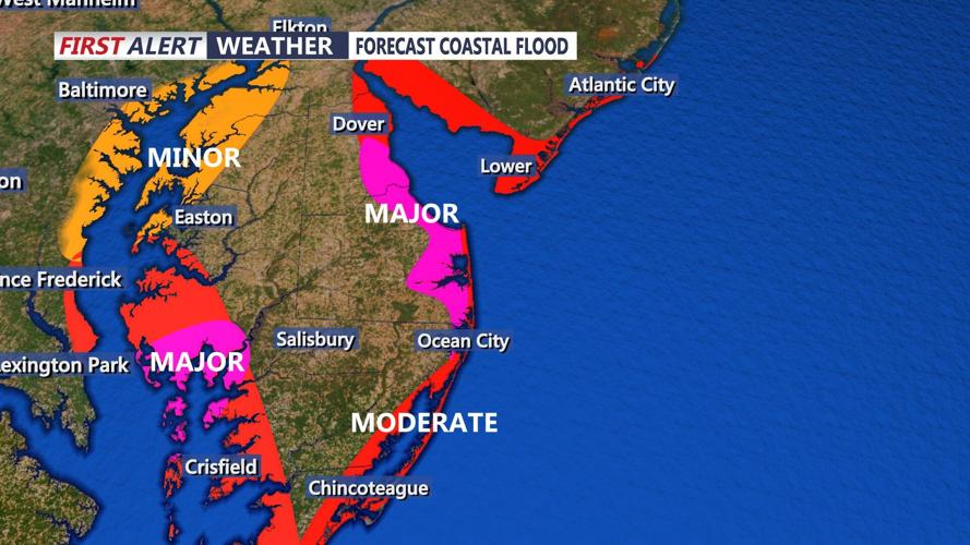
Coastal flooding is expected, especially in low-lying areas and those with poor drainage. Major flood levels are possible in bay communities. There is no full moon yet, so that will help with tides. The worst flooding will occur during the high tides Saturday morning and afternoon. Some flooding could linger into Sunday mornings high tide.

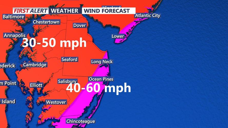
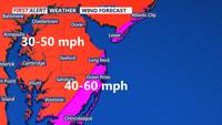
Winds this evening have already been gusting to as high as 45 mph at the Indian River Inlet. These winds will continue to pick up overnight. Wind gusts as high as 60 mph will be possible into early Saturday afternoon. Breezy conditions remain into Sunday morning. Inland areas of Delmarva will see gusts as high as 50 mph.

Saturday afternoon will feature the chance of some thunderstorms as the center of Ophelia approaches the region. An isolated tornado or two cannot be ruled out Saturday afternoon.
Be sure to download the CoastTV Weather app for the latest weather information and the CoastTV News app for more on closures and safety warnings from officials.