


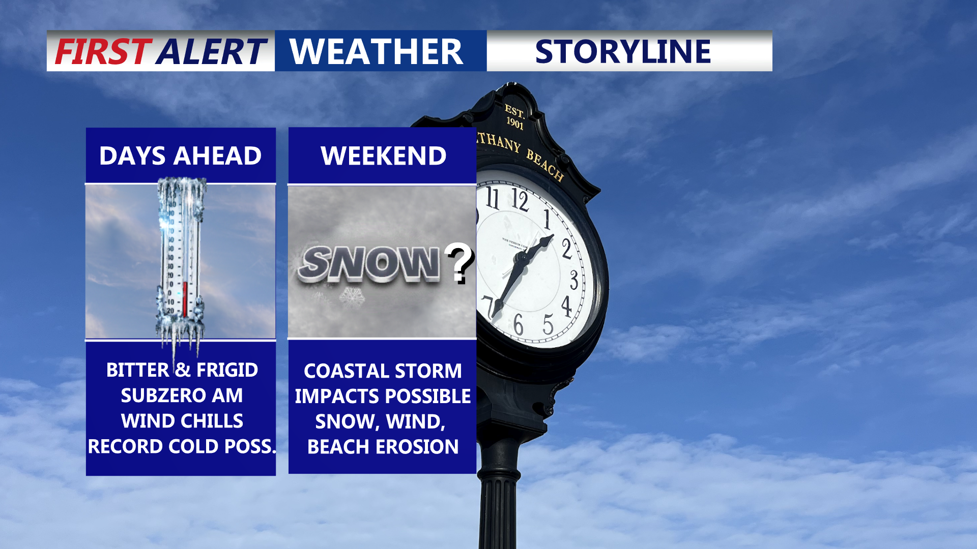

Delmarva is settling into a prolonged, dangerous stretch of cold through the end of the week, with daytime highs stuck in the 20s and overnight lows dropping into the single digits—creating wind chills below zero at times. Friday could challenge a record for the coldest high temperature. Attention then turns to a rapidly strengthening coastal storm this weekend that could bring snow, high winds, and coastal flooding, though the exact track (and impacts) remain uncertain.
From
To

A rare and potentially record-setting blast of Arctic air settles over Delmarva, bringing highs stuck in the 20s and low 30s but feeling much colder due to wind chills. By midweek into Friday night, overnight lows drop to the single digits, with wind chills well below zero—cold enough for frostbite and hypothermia within minutes. We are also watching a potential coastal storm late Saturday into Sunday that could bring snow, strong winds, and coastal flooding/erosion concerns.

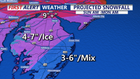
Delmarva stays seasonably cool today before an arctic front brings dangerous subzero wind chills overnight, followed by a major winter storm with snow, sleet and freezing rain from Saturday night into early Monday afternoon.

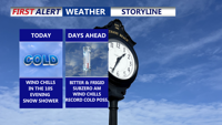
Delmarva stays mostly mild and mostly dry today, but a sharp cold front brings a quick hit of showers and possible snow showers early Thursday, followed by dangerous wind chills into Friday.

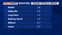
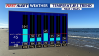
After a morning snowfall that left Sussex County and parts of the Eastern Shore with up to 2 inches of accumulation, Delmarva prepares for thawing conditions as temperatures rise into the upper 30s and 40s through Monday. A midweek arctic blast is expected to bring colder temperatures and breezy conditions.

Delmarva will face frigid temperatures as an Arctic high-pressure system brings some of the coldest weather in years. Lows may dip into the single digits Sunday night, with daytime highs struggling to rise above the upper 20s to low 30s. A weak system could bring light snow or rain showers late Monday into Christmas Eve, followed by moderating temperatures heading into the holiday weekend.