


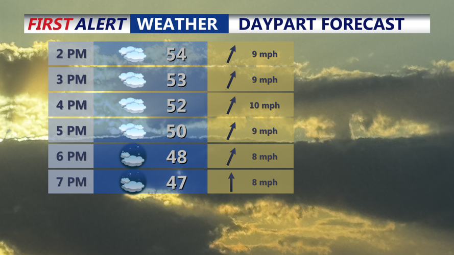

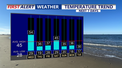
DELMARVA -- Today is the peninsula’s last relatively mild day before a big temperature drop. Skies stay mostly cloudy with the chance for a brief sprinkle, but most areas remain dry. Afternoon highs will top out in the low to mid 50s.

Mostly cloudy skies, one last mild day in the low to mid 50s. Spotty sprinkle can't be ruled out.
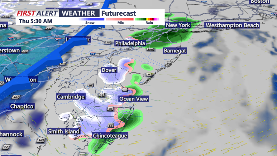
Clouds thicken tonight as a cold front approaches. A few brief showers are possible late tonight into predawn Thursday, with the potential for a changeover to snow showers in spots before the system quickly moves out. Current trends point to a drier, faster-moving setup, limiting any wintry impacts.

Cold front pushes through late tonight bringing a brief round of rain/snow showers.
Behind the front, Thursday turns sharply colder and windy. Temperatures fall into the 20s and 30s early Thursday and stay in the 30s through the day, with northwest winds gusting 30 to 35 mph. That will keep wind chills in the teens and 20s Thursday afternoon. By Thursday night into Friday morning, wind chills drop into the single digits across much of Delmarva.

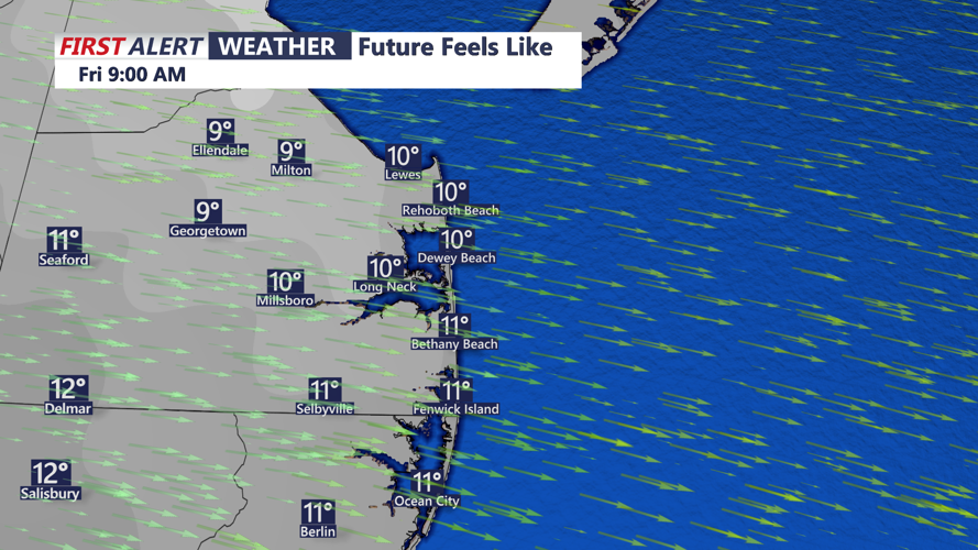
Wind chills in the SINGLE digits Friday morning, dress warm.
Cold air holds on into Friday, though winds gradually ease and turn more southwesterly later in the day. Highs Friday range from the upper 20s to the mid 30s, but wind chills remain in the 20s for much of the day.
Looking ahead, a brief warmup toward near-normal temperatures is possible Saturday ahead of another cold front. Then confidence is increasing in an extended stretch of below-normal temperatures beginning Sunday and lasting through at least the middle of next week, with multiple nights of wind chills in the single digits and teens A late rain shower possible Saturday and an area of low pressure will pass offshore Sunday could track close enough to bring some light snow to the coast Sunday afternoon-evening. The risk of significant wintry weather beyond Thursday remains low, but with cold air in place, even small changes in future systems could bring a return of snow chances.