


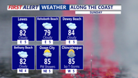
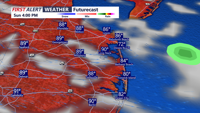
Scattered showers continue overnight with areas of fog by Sunday morning.
From
To

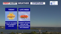
Delmarva is enjoying sunny, comfortable weather today thanks to high pressure moving into the region. Humidity stays low with highs in the upper 70s to low 80s, but hotter and more humid conditions return by Friday along with renewed thunderstorm chances that may linger into the start of the weekend.

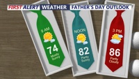
Summer officially arrived early this morning, with great weather in store for Father's Day.

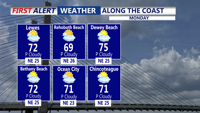
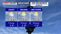
Delmarva will enjoy a pleasant start to the week with seasonable temperatures, lower humidity, and mainly sunny to partly cloudy skies through Tuesday. Minor coastal flooding is expected again with Monday evening’s high tide along the Atlantic coast and Delaware Bay. Heat and humidity return by midweek, with a chance for severe thunderstorms Thursday afternoon and evening before a fantastic Father’s Day weekend settles in.

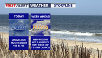
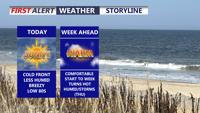
Delmarva starts the week cooler and much drier behind a backdoor cold front, with mainly dry weather expected through Tuesday. Temperatures will quickly rebound by midweek, followed by dangerous heat and humidity Thursday into Friday, along with daily thunderstorm chances from Wednesday through the weekend.

High pressure is building in from the north, bringing cooler and breezy weather for Monday.

Mainly clear and cooler overnight with lows in the 60s.

A cold front will sweep through Delmarva this afternoon, helping to break the heat.


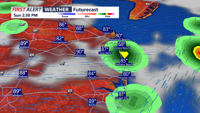
A cold front will sweep through on Sunday, helping to break the heat.

Showers and thunderstorms may develop in a few spots.