


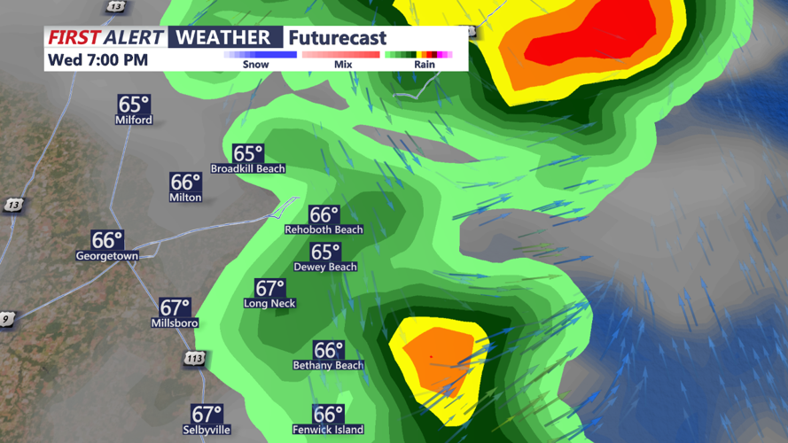


DELMARVA- Dry start Wednesday morning before the axis of a broad upper-level trough shifts overhead in the afternoon, bringing showers and thunderstorms back into the forecast. Clearer skies earlier in the day will allow for strong daytime heating, but thanks to the front passing through the region on Tuesday, low-level moisture will be on the lower side, surface dew points in the mid-50s at best.

Putting all the pieces together, a few stronger thunderstorms will be possible, but severe potential remains overall low.
Putting all the pieces together, a few stronger thunderstorms will be possible, but severe potential remains overall low. The cold front will continue to cross through the region during the first half of Wednesday night before moving offshore. Surface high pressure will build in from the northwest over time. Though some shortwave energy may keep conditions slightly unsettled on Thursday, surface high pressure will dominate the region through the rest of the short term.
There are no significant weather concerns in this forecast. The WPC does not have our region outlooked for any excessive rainfall, and the SPC does not have our region outlooked for any severe weather. The chance of showers and thunderstorms will continue into Wednesday night due to the cold front and upper-level shortwave passing through, with PoPs diminishing over time.