



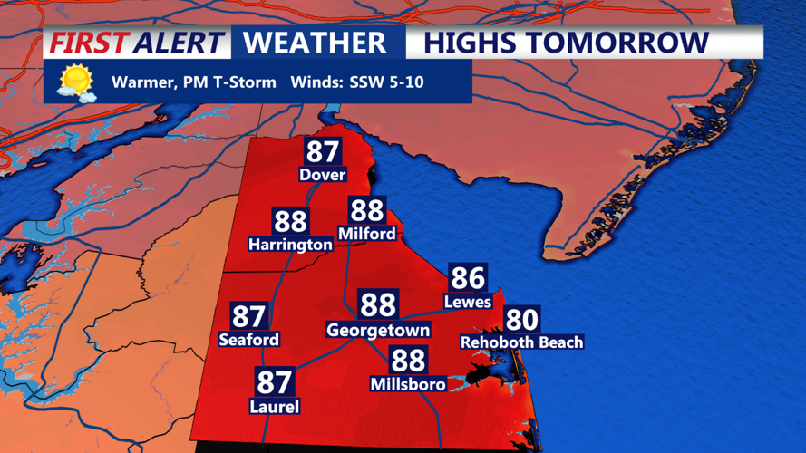
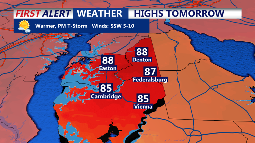

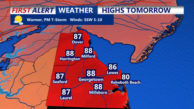
DELMARVA - Will start the week with more clouds as a shortwave of energy rotates around an upper-level low situated to our northeast. The combination of this weather pattern and rising dew points could trigger some isolated showers and perhaps a few thunderstorms.

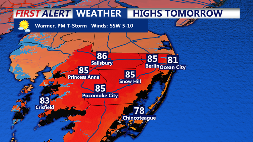
However, due to limited instability, severe weather is not expected. A few areas may see downpours, flashes of lightning, or a wind gust up to 30 mph, but most of the region will remain dry. High temperatures will climb into the upper 80s, with some spots approaching 90 degrees. Dew points will rise to the mid-60s, making it feel noticeably more humid.

The upper low over the Northeast U.S. will begin to depart Monday night, leading to clearing skies and diminishing storm chances across Delmarva. Patchy fog may develop overnight as temperatures cool slightly. On Tuesday, a brief upper ridge will bring mostly sunny skies to the region. Highs will again reach the 80s to near 90 degrees, with dew points remaining in the 60s.
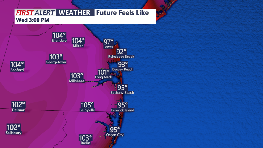
By Wednesday, a stronger push of warm air and moisture will result in higher temperatures, with highs in the mid to upper 90s across much of Delmarva. Dew points will also rise into the 70s, pushing heat indices near or above 100 degrees, potentially prompting heat advisories. A weak shortwave passing through Wednesday night could trigger showers and thunderstorms, especially in the late afternoon and evening, as a cold front moves through the area.

The extended forecast into Labor Day weekend shows an increasingly unsettled pattern, with multiple chances for showers and thunderstorms. A shortwave will move through late Thursday into Thursday night, bringing another round of storms, particularly in the western areas of Delmarva. Another disturbance is expected to arrive Friday night, followed by a cold front later in the weekend. Despite the active weather, there will be intervals of dry conditions. Temperatures will be near normal on Thursday, dipping below normal on Friday and Saturday, before returning to near-normal levels by Sunday.
