


DELMARVA - Bermuda high pressure will remain in control through much of the weekend, maintaining hot conditions across Delmarva. A backdoor cold front will move in from the north on Friday, stalling over the area into Saturday before returning north as a warm front. A stronger cold front is expected to approach the region on Sunday, likely passing through on Monday. High pressure will return on Tuesday, followed by another front around Wednesday or Thursday.
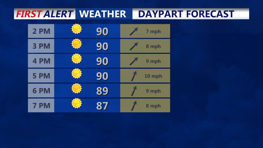
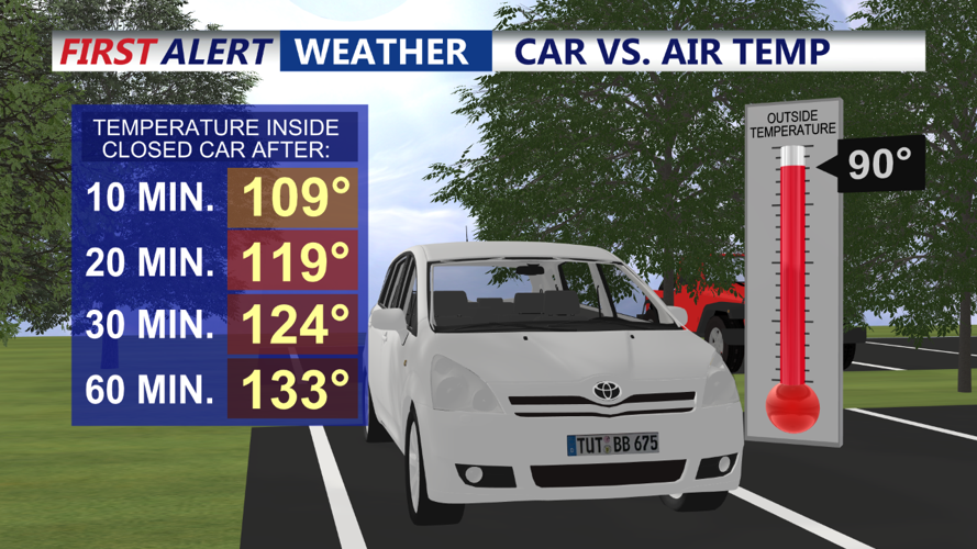
A Heat Advisory will continue through this period, with apparent temperatures reaching the mid-90s this afternoon and some upper 90s. The heat will intensify tomorrow, resulting in a growing number of apparent temperatures in the upper 90s. Overnight lows will range from the mid to upper 60s for most areas, with lower 70s in urban environments.
The forecast area will remain precipitation-free overnight and into tomorrow morning and early afternoon. However, a backdoor cold front will approach from the north tomorrow, providing a focus for showers and thunderstorms north of I-195 in NJ and the PA Turnpike. Slow-moving thunderstorms will likely produce heavy rain and localized flooding, especially in northern areas. Some localized severe thunderstorms could bring damaging wind gusts. The Storm Prediction Center (SPC) has a Marginal Risk (1 out of 5) for portions of the southern Poconos, northern New Jersey, and the Lehigh Valley.
Showers and thunderstorms will be slow-moving due to lighter winds, which will also affect surface winds. Expect south to southwest winds at 5 to 10 mph, except along the immediate coast and bays where sea/bay breezes will shift more southeast and gust to 15 or 20 mph Friday afternoon.
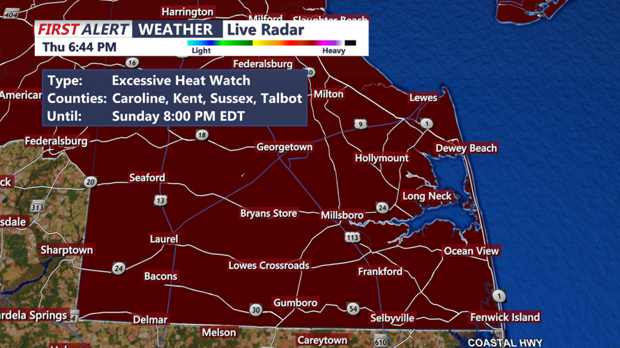
Sussex County and Sussex County Beaches:
Sussex County and its beaches will experience hot and humid conditions under the Bermuda high pressure system. Daytime highs will approach the upper 80s to low 90s, with apparent temperatures in the mid to upper 90s. The overnight lows will be more comfortable, in the mid to upper 60s.
While the immediate area may avoid significant precipitation, the approaching backdoor cold front could trigger some showers and thunderstorms nearby, especially towards northern Sussex County. Keep an eye on weather updates, as localized storms could bring heavy rain and gusty winds.
Residents and visitors should take precautions during the Heat Advisory, staying hydrated and avoiding prolonged exposure to the sun. Prepare for potential thunderstorms on Friday afternoon and monitor weather reports for any changes.
Stay safe and enjoy your weekend, Delmarva!
