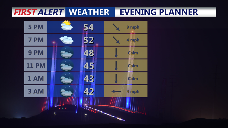
DELMARVA - For the rest of Saturday afternoon and evening skies remain mostly cloudy skies with diminishing winds and temperatures in the 50s. Winds continue to diminish this evening and overnight. Skies partially clear with lows in the 30s by morning.
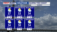
Sunday will turn a bit cloudier, but conditions remain pleasant with highs in the 50s and low 60s, and breezy conditions continue. A few showers are possible later Sunday night and Monday morning, with lows in the 40s.
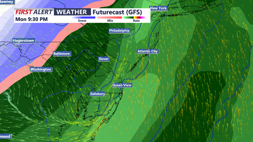
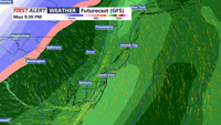
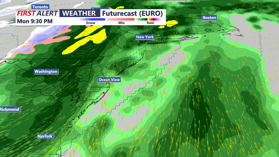
By Monday, the weather turns much more active. Warmer, more humid air will surge into Delmarva ahead of a strong cold front sweeping east from a deepening storm system moving through the Great Lakes into Canada. Showers may begin developing Sunday night into Monday morning as warm air advection increases and deeper moisture arrives. A rumble of thunder cannot be ruled out late Sunday night.
Despite the showers, temperatures on Monday will rise well into the 60s across much of the region, with some lower 70s possible. Humidity will also increase noticeably, with dew points pushing toward 60 degrees. Through the day, widespread showers and thunderstorms are expected to develop as the approaching front and strong upper-level system provide increasing lift.
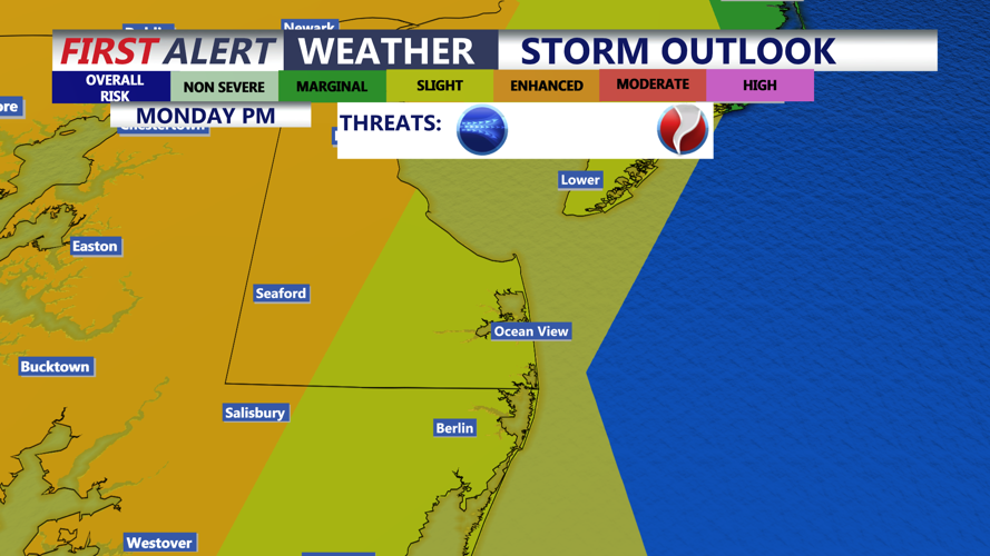
There is growing concern that some of those thunderstorms could become strong to severe Monday afternoon and evening. While cloud cover and ongoing showers may limit instability somewhat, the atmosphere will feature very strong wind fields and impressive wind shear. That setup could support a squall line or fast-moving line segments capable of producing locally damaging wind gusts. If surface winds remain favorably aligned, some storm rotation may also develop. Heavy rain is also likely at times, with plenty of moisture in place ahead of the front.
Once the cold front pushes offshore Monday night, much colder air will spill back into Delmarva. Gusty winds will shift from the south to the west and northwest, with gusts again reaching 30 to 40 mph. There is a small chance lingering precipitation could briefly mix with or change to snow before ending, though that will depend on how quickly the moisture exits behind the front.
Tuesday, St. Patrick's Day will feel sharply colder, with some areas struggling to reach 40 degrees for afternoon highs. A gusty westerly wind will make it feel even colder, with wind chills dropping into the 20s and 30s. Wednesday stays chilly as well, although winds should ease some compared to Tuesday.