


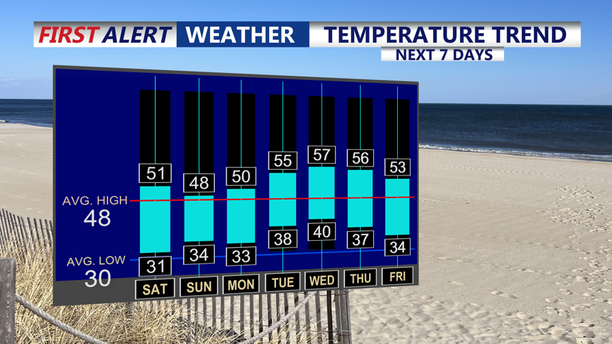


DELMARVA - Residents along the Delmarva shoreline from Sussex County’s beach towns to Ocean City can expect a cold, mostly dry stretch late Friday evening through late Saturday evening, with the best odds for any snow staying well to the north.
Skies will be partly to mostly cloudy at times Friday night as a quick-moving disturbance passes through the broader Mid-Atlantic. The more organized snow showers are expected across parts of Pennsylvania and northern New Jersey, while coastal Delaware and Maryland’s oceanfront sit on the southern edge of the action.
For Sussex County — including Lewes, Rehoboth Beach, Dewey Beach, Bethany Beach and Fenwick Island — conditions should remain largely precipitation-free. Still, a stray flurry can’t be ruled out very late tonight into early Saturday, especially closer to northern portions of the region, but any snowfall that does reach the ground would be brief and minor.
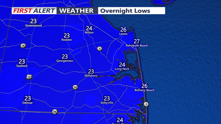
Even without much in the way of snowfall, the bigger story will be the cold. Overnight lows are expected to drop into the mid-teens to low 20s, cold enough for any leftover damp spots to freeze. Motorists and pedestrians should watch for isolated slick patches on untreated roads, bridges, overpasses and sidewalks, particularly around daybreak Saturday.
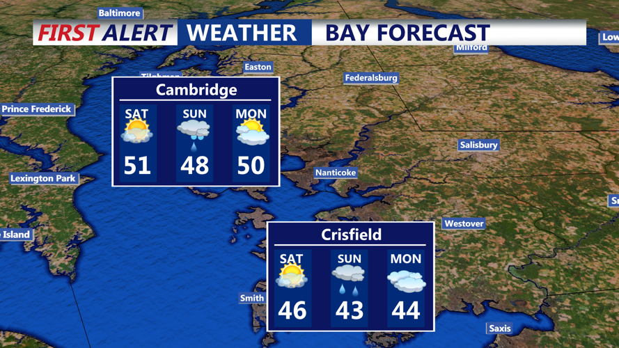
Saturday will turn dry as any early-morning flakes fade quickly. Afternoon temperatures are expected to stay on the cold side — generally near freezing to the mid-30s — before another chilly Saturday evening settles in along the coast.
