


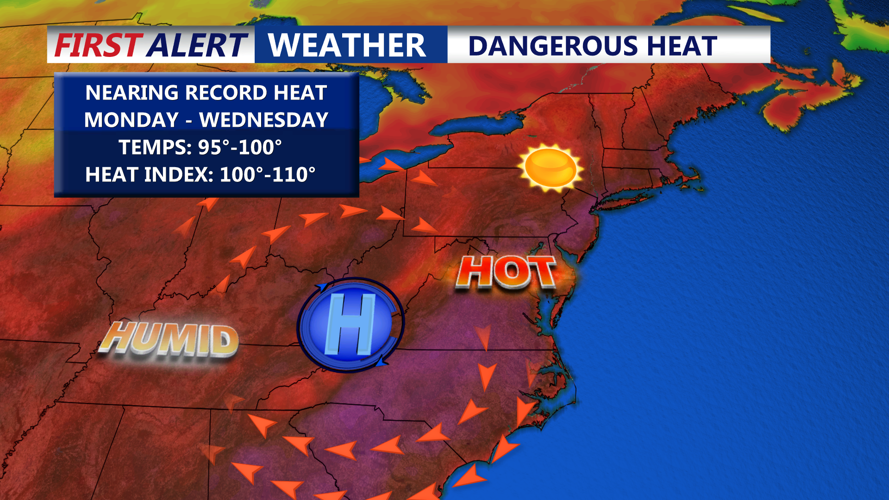
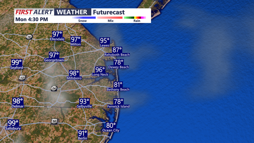
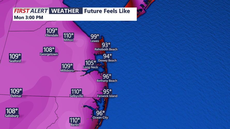


DELMARVA -- A stretch of dangerously hot weather is expected this week, as a ridge of high pressure over the western Atlantic pushes inland, fueling a heat wave across the region. Temperatures are forecast to the mid to upper 90s, with heat index values between 100 and 110 degrees across most inland areas this afternoon and evening.

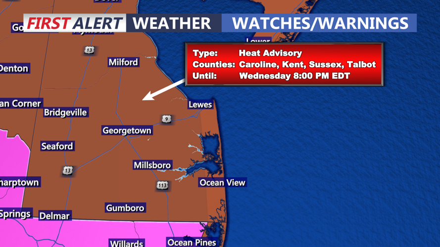
The high-pressure ridge is expected to center itself over the Appalachian region through Tuesday, locking in a hot and humid air mass. Although dew points may mix down slightly during peak heating, the heat and humidity combined will create sweltering conditions, particularly in southern portions of the peninsula. A Heat Advisory remains in effect for Delaware and parts of the eastern shore, with an Extreme Heat Warning for Maryland, including Salisbury, Snow Hill, Cambridge, and Pokomoke City. The combination of temperature and humidity could push conditions into dangerous territory.

The worst of the heat is expected today and Tuesday, as the atmospheric ridge strengthens. Overnight conditions will offer little relief, with lows in the upper 70s to near 80 degrees both nights.


Tuesday we could hit 100 degrees for the first time since July 21st, 2019 and with that we would break a record high temperature of 97 set back in 2010.
By Wednesday, the ridge will begin to shift southward and weaken slightly. Highs will remain in the mid to upper 90s with heat index values still near 101-105 degrees. Nonetheless, Wednesday will mark the fourth consecutive day of oppressive heat across Delmarva.

A change in the weather pattern arrives late in the week. As the upper-level ridge begins to erode, a surface trough will approach from the north. This will introduce increased cloud cover and the potential for scattered showers and thunderstorms, especially Thursday through the weekend. Some of these storms could be severe.
By Friday, temperatures are forecast to fall into the 80s, much closer to seasonal normals. Rain chances remain elevated into the weekend, marking a return to a more typical summer pattern.