


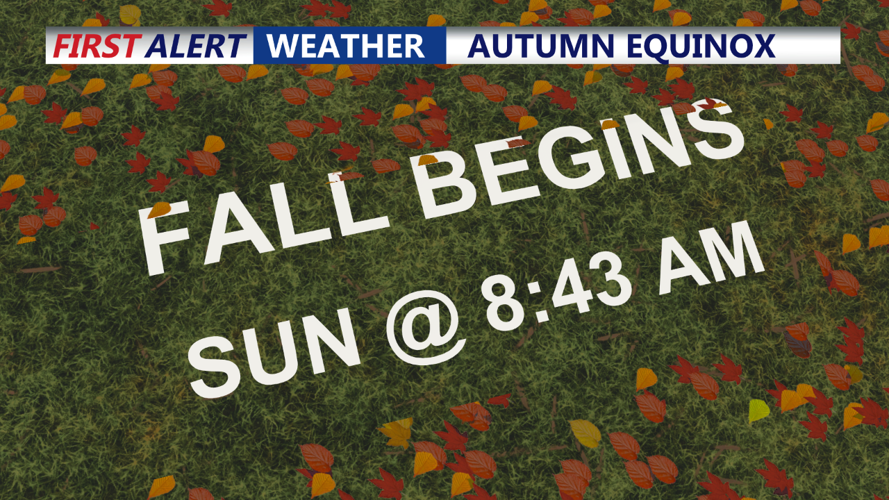


DELMARVA -- A mid-level trough along the Mid-Atlantic Coast on Sunday morning will bring a small chance of showers to southern parts of Delmarva. However, any rainfall is expected to taper off by midday. As the afternoon progresses, clouds will decrease, allowing for some sunshine. Highs will range from the upper 60s to mid-70s, providing a pleasant start to the Fall season.

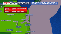
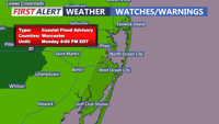
Coastal Flood Advisories continue through 5PM today as well as a dangerous risk for rip currents. We continue to see 4 to 6 foot waves thanks to the coastal storm that is still meandering some hundreds of miles to our east.


High pressure will dominate the region from Sunday night into Monday, ensuring mostly dry conditions. Overnight lows will dip into the 50s across much of Delmarva, with coastal areas remaining slightly warmer around 60 degrees due to the influence of the ocean. Some patchy fog is once again possible into Monday morning.
On Monday, temperatures will again reach the low to mid-70s, under a mix of sun and clouds. However, a slow-moving cold front will approach from the west late Monday. This front may stall before reaching Delmarva, but shortwave energy ahead of it could trigger scattered showers late Monday into Tuesday. Rain chances will be highest in the western part of the region, although any precipitation is expected to be light.
Tuesday will see temperatures around 70 degrees, with continued slight chances of showers, particularly in the morning hours as the front remains nearby.
The long-term forecast points to a more unsettled period beginning Tuesday night. A new upper-level trough will push eastward, dragging the cold front closer to Delmarva by Wednesday. This development will bring more widespread showers Tuesday night into Wednesday night, with likely rain chances during this time. However, there is some uncertainty in the forecast, as models show inconsistencies in the timing and intensity of the rain.
The front may linger near the region through Friday, potentially keeping the weather unsettled with periodic showers. Temperatures will trend a few degrees below normal for the latter half of the week, as the Fall weather pattern fully establishes itself.
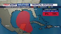
National Hurricane Center has the area in Southern Gulf of Mexico as a 70 percent chance to develop into a tropical cyclone over the next 7 days. All interests along the Gulf Coast need to play close attention to the forecast this week.
