


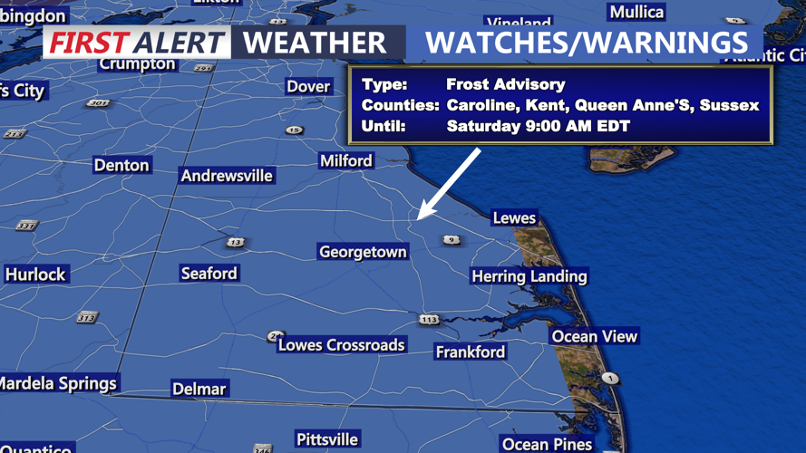


DELMARVA -- A Frost Advisory is in effect for a majority of Delmarva into Saturday morning. Then a cool and dry weekend on the way.

Cover or bring in your tender plants this evening. There is a Frost Advisory tonight for much of Delmarva, with the exception of the immediate coast. Skies will clear shortly after sunset, allowing temperatures to drop into the mid 30s away from the coast and upper 30s to low 40s along the shoreline. The chill comes courtesy of surface high pressure anchored over eastern Canada, which will continue to control the weather through the weekend.


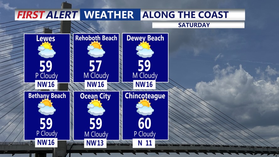
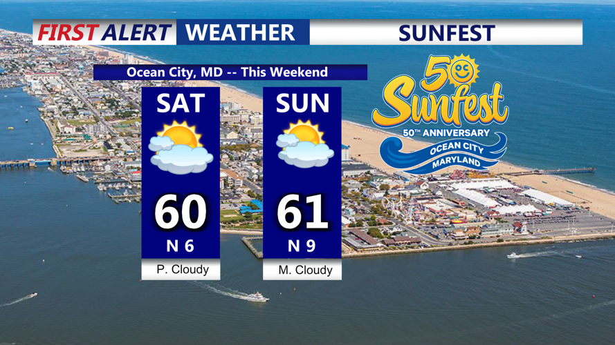
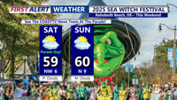
Saturday and Sunday will bring more tranquil conditions, though skies may turn partly to mostly cloudy at times. Highs will remain in the upper 50s to around 60 degrees on Saturday, with similar conditions by Sunday. Overnight lows will hover in the 30s and low 40s both nights. Seasonably pleasant for late October.

Looking ahead to early next week, quiet and cool weather continues on Monday with highs in the 50s. However, the First Alert Weather team keeping an eye on a developing system that could bring a shift by midweek.

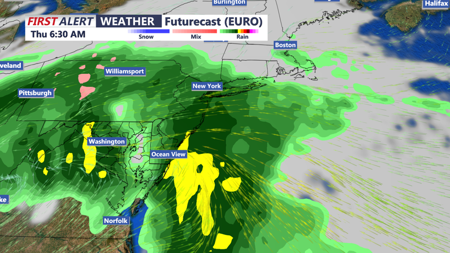
Low pressure may form somewhere along the Mid-Atlantic or Southeast coast between Tuesday and Wednesday, potentially bringing periods of rain, some of it possibly heavy, along with gusty east to northeast winds and beach erosion. While details remain uncertain, the chance for unsettled weather increases by Tuesday and Wednesday. Temperatures are expected to stay below normal throughout this stretch.