


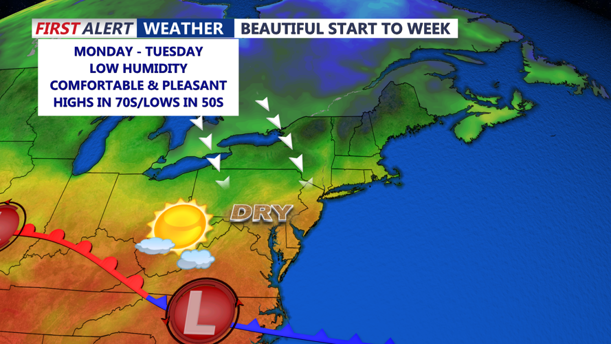


DELMARVA -- A bright and breezy start to the week as high pressure takes hold the next couple of days. Mostly sunny skies and seasonal temperatures in the mid to upper 70s will dominate the early part of the week, though gusty winds of 25 to 30 mph are likely during the daytime Monday due to a tight pressure gradient across the region. Cooler low to mid 70s are expected for Tuesday.

A strong area of Canadian high pressure centered near Hudson Bay is gradually pushing south through the Great Lakes into the Mid-Atlantic, reinforcing dry air and keeping conditions calm through Tuesday. Overnight lows will dip into the upper 40s and low 50s with lighter winds.

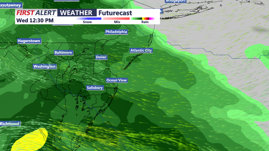
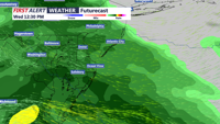
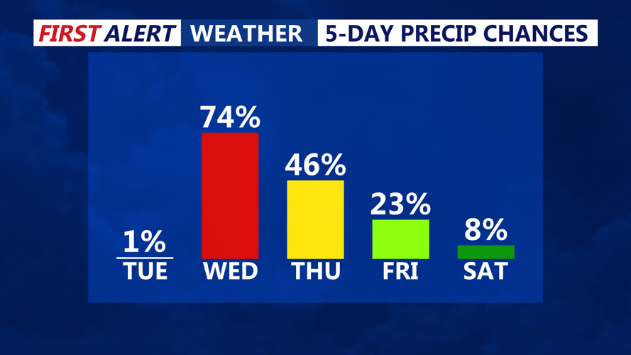
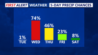
Clouds begin increasing Tuesday evening as the next weather system approaches from the southwest. By early Wednesday morning, widespread rain is expected across the region, with the potential for periods of heavier precipitation as frontogenetic banding enhances rainfall. Highs will struggle to climb out of the 50s to low 60s on Wednesday, making for a noticeably cooler day.

The storm system responsible for Wednesday’s rain will move out by Thursday, but unsettled conditions are forecast to persist through the rest of the week. A new coastal low is expected to form off the Mid-Atlantic coast and track northeast into New England, continuing the threat of scattered showers into Friday. Highs will only be in the 60s the rest of the week, with chilly 50s at night.
A drying trend starts just in time for the Memorial holiday weekend. At this point it looks dry and pleasant Saturday through Memorial Day Monday. Highs in the 70s with lows in the 50s.