


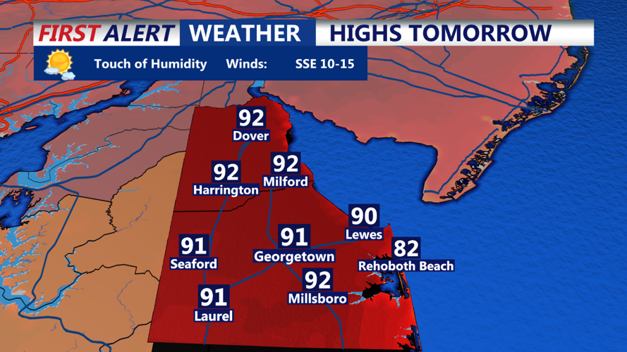


DELMARVA - Surface high pressure will slowly slide eastward through tonight as a cold front, currently over the Great Lakes, presses southeastward toward us. Despite this shift in surface pattern, the flow will not bring the big surge of humidity until tomorrow, so we have one more night of relatively low humidity.
The ridge axis is shifting right over us then will move offshore tonight. Earlier some mainly high clouds passed over the ridge and kept today from being perfectly sunny, but greater cloud cover will not invade until tonight.
Most of tonight should also be dry, but as the warm front with the humidity push moves in late tonight, some dying convection approaching from the northwest could bring a late-night shower or thunderstorm. Lows tonight staying a touch milder with the clouds and humidity starting to build, with 60s common.
