


DELMARVA -- The first day of July, is feeling like July with another hot and steamy day for Delmarva, with mostly sunny skies and highs ranging from the upper 80s to the low 90s. Feels like temperatures will top out in the lower 100s inland, with 80s and 90s at the coast. Stay hydrated with water the rest of today and stay in AC as much as possible. Despite the heat, much of the day should stay dry as a cold front approaches from the northwest.

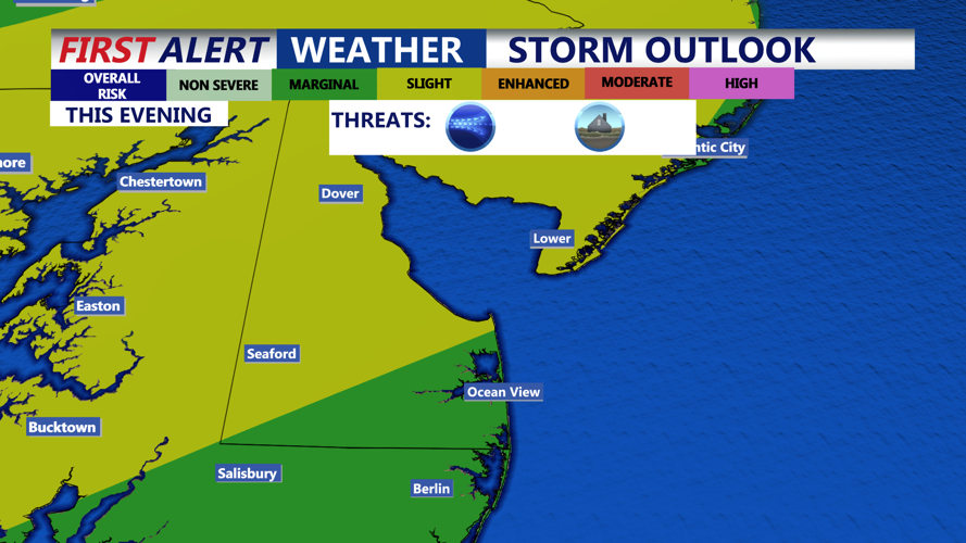
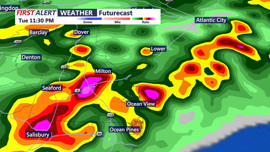
As the front draws closer later this afternoon and evening, there will be a window for scattered thunderstorms to develop. Storms are expected to move into the area after 7PM. The Storm Prediction Center has a portion of the peninsula in a "Slight' risk (2 of 5) for severe storms.

The primary threat is damaging winds and flash flooding. The severe weather threat is expected to diminish gradually after midnight. However, the cold front will slow down as it moves into the region, remaining near the coastline into Wednesday morning.
Overnight lows Tuesday will dip into the low 70s, with lingering pockets of moisture potentially fueling a few showers or a stray rumble of thunder before dawn.
By midday Wednesday, the cold front should be positioned to the south and east of Delmarva. While daytime highs will remain warm, dew points are forecast to drop modestly behind the front, offering some relief from the oppressive humidity of recent days. High temperatures will be in the upper 70s and low 80s.
Even though an upper-level trough will remain in place, the atmosphere is expected to have less moisture overall, limiting instability. As a result, any lingering showers should taper off early, with little to no chance of rain or storms through the remainder of Wednesday and into Wednesday night.
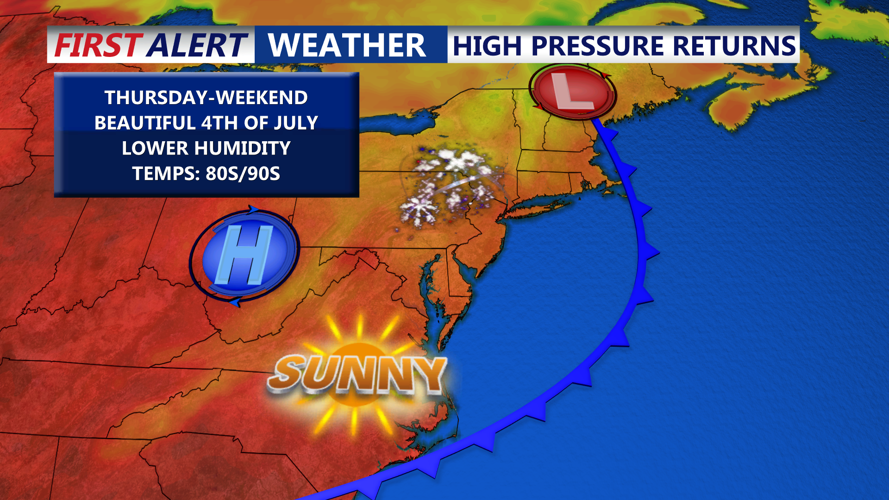
The weather pattern becomes more settled heading into the end of the week and the holiday weekend. A reinforcing upper-level trough over the Northeast will gradually shift offshore, while surface high pressure continues to build over the Mid-Atlantic.

Thursday will remain warm with highs in the upper 80s and a dry forecast, although a weak cold front could briefly sink southward later in the afternoon or evening. No significant precipitation is expected from this feature, and high pressure will re-establish control over the area Friday into Saturday.

Independence Day appears to be the most comfortable day of the period, with warm sunshine and lower humidity creating pleasant conditions for early Fourth of July celebrations. High temperatures will be in the mid 80s, then 70s with dry conditions around fireworks time.
Temperatures will trend a bit warmer again Saturday and Sunday, with highs in the upper 80s each afternoon. Dew points will rise gradually, moving back into the upper 60s to around 70 by Sunday. As the high shifts offshore late in the weekend, a return of more humid conditions is possible, but most of the period will remain dry and favorable for outdoor activities.
