


DELMARVA - A stretch of clear and seasonable weather continues as Canadian high pressure builds in from the north, shunting Hurricane Imelda out to sea.

Out the door this morning make sure to dress for breezy and chilly conditions with temperatures in the 50 and 60s, but feeling cooler with the breeze.
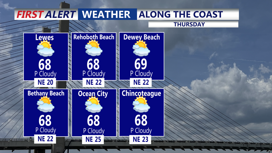
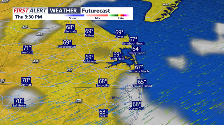
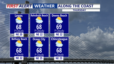
For Oct. 2, the center of high pressure will be positioned over New England, extending south into the Mid-Atlantic. Both Humberto and Imelda will be well east of the coast by then, leaving Delmarva with another cool and dry day. Highs will top out in the mid to upper 60s with patchy high clouds limiting radiational cooling Thursday night. Temperatures will settle into the low to mid-50s.
By Friday, the high will shift closer to Long Island, ushering in slightly warmer air. Highs will reach the low 70s Friday afternoon before slipping into the upper 40s and low 50s overnight.

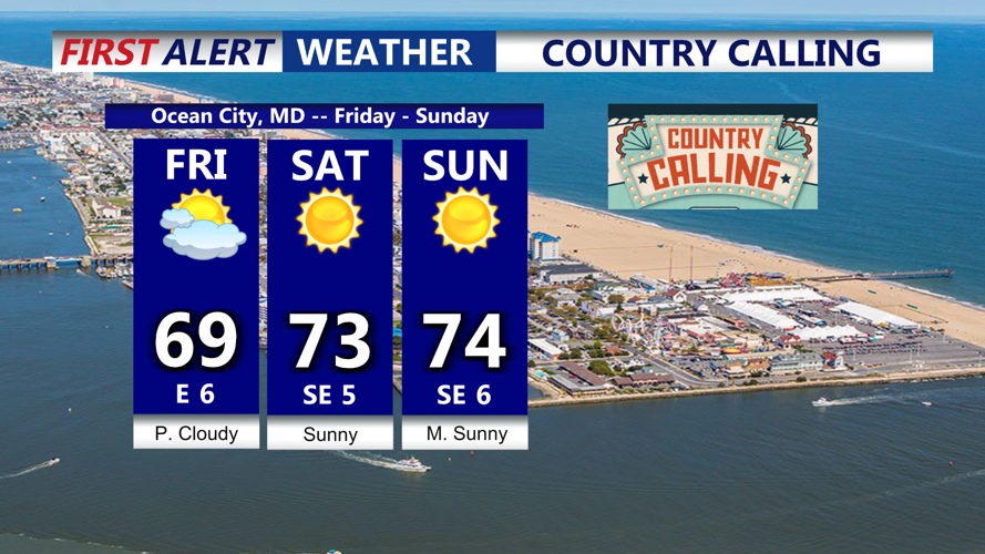
Looking absolutely perfect for Country Calling in Ocean City, kicking off Friday through the weekend. Certainly much better than last weekend.
The weekend will bring a milder trend as the high sets up just off the Mid-Atlantic coast. Highs on Saturday are expected in the mid to upper 70s. From Sunday through Tuesday, temperatures will climb further, reaching the upper 70s to low 80s. Nighttime lows will range from the low 50s over the weekend to the upper 50s and low 60s early next week.
Most of the period will be dry, with sunshine dominating through Monday. By Tuesday afternoon, a cold front approaching from the west could bring a few showers and thunderstorms to the region.