



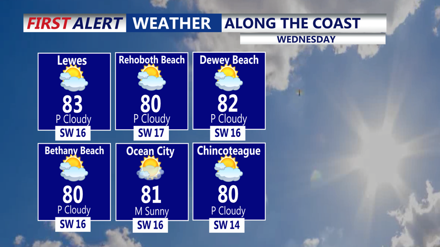



DELMARVA - The month of October is off to a warm start, with temperatures in the 70s and 80s this afternoon. Skies are mostly sunny to partly cloudy with the warm temperatures.

High pressure will continue to slide offshore today, as southwest winds return, that opens the door for even warmer temperatures as the humidity creeps up. Dew points will be in the upper 60s. A summer-like feel will be back despite the calendar flipping to October. For tonight, skies will be mostly clear with areas of fog possible, and lows in the mid 60s.
Friday will feature partly cloudy skies and a summer-like day with highs in the mid 80s. A cold front will approach at night that could spark of a shower, not expecting much in the way of rain or storms.

By the weekend we are much cooler, temperatures are back int the 60s, Saturday will feature mostly cloudy skies and northeast winds. The cold front will stall to our south. An area of low pressure will ride along the stalled front late Saturday into Sunday. The latest trend has low pressure moving up the front, bringing a soaking rain to a lot of the region. Highs Sunday will be in the mid 60s, with a damp breeze.

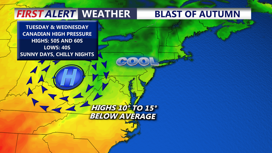
Monday will be in the upper 60s to low 70s under partly to mostly cloudy skies ahead of a blast of autumn Tuesday and Wednesday. Canadian high pressure builds in and highs will only be in the 50s and 60s, with some chilly mornings Tuesday and especially Wednesday, with lows in the mid 40s.
