


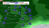


DELMARVA - Expect plain rain this afternoon and evening, with pockets of freezing rain across the eastern shore, and north of Sussex county.
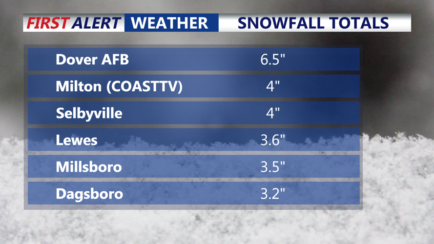
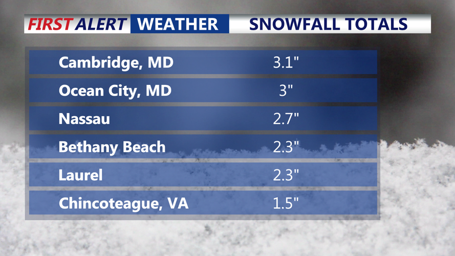
A general 3-6 inches of snow fell across the region earlier today, with a light accumulation of sleet as well. Roads remain treacherous this afternoon with slushy and snow covered conditions. Conditions will improve later today as the plain rain and warmer temperatures will help wash away some of the slush. But remember, small ice accumulations can make roads nearly impassable and increase the chance of scattered power outages. This risk is the highest across the eastern shore extending into Kent county and points north.
Conditions are expected to gradually improve Sunday evening, though patches of drizzle, including freezing drizzle may linger into the night. A slight chance of light snow is also possible late Sunday night into early Monday.
From Monday morning into Monday afternoon, the primary hazard will shift from falling precipitation to lingering ice and refreezing. Temperatures are expected to remain at or below freezing, and any slush or standing water left behind from the afternoon mix Sunday could freeze solid, creating slick spots on roads and walkways even after the storm winds down.
Residents are urged to take precautions throughout the storm, including staying off the roads if possible, charging phones and devices ahead of any outages, and keeping flashlights and extra blankets accessible. Drivers who must travel should slow down, increase following distance and keep an emergency kit in their vehicle with water, snacks and gloves.
Expect a bitterly cold and dry week ahead, temperatures won't get above the freezing mark through all of next week. Daytime highs in the teens and twenties, single digit overnight lows and subzero wind chills.
Stay up to date on the approaching winter storm with radar and hourly forecasts in the CoastTV weather app, available for Apple and Android.