


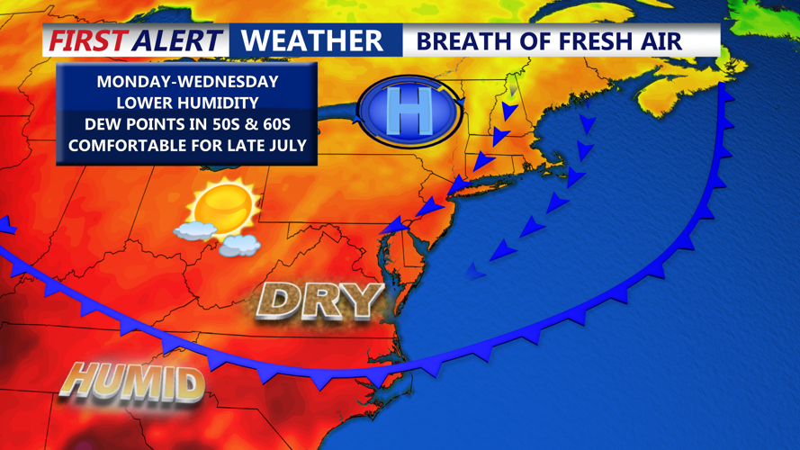


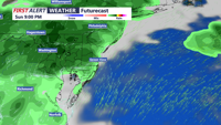

DELMARVA- A cold front is moving south across Delmarva this afternoon. Drier and cooler air is filtering into the region from the north. Skies are clearing this afternoon with warm temperatures and comfortable humidity levels. The pleasant weather continues through midweek.

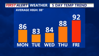
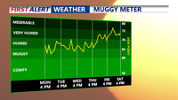
In the wake of the front, a stretch of more pleasant weather will settle in. Dewpoints will drop into the 50s and 60s and highs will remain in the low to mid 80s into Wednesday. A large area of high pressure, and a supporting upper-level ridge will help keep conditions dry and comfortable for Delmarva. Comfortable sleeping conditions at night as temperatures dip into the mid 60s, with 70s at the immediate coast.


