


DELMARVA - Monday marks the beginning of another stretch of unsettled weather for Delmarva, as a stalled front remains north of the region, setting the stage for a series of thunderstorms into Tuesday, along with very warm and muggy conditions.
Mostly sunny skies this afternoon will help temperatures surge into the upper 80s to low 90s, inland locations could see upper 90s to 100 degree heat indices prior to any storms developing. Make sure to take it easy in the heat and stay hydrated with water.

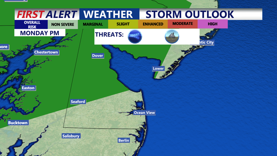
The afternoon heat and humidity will fuel isolated to scattered showers and thunderstorms across the region. Although the wind shear is expected to increase somewhat compared to Sunday, it will still be a limiting factor in widespread severe development. Storms could produce isolated strong downbursts capable of damaging wind gusts. Brief torrential downpours are possible.
The Storm Prediction Center has placed a portion of the peninsula under a Marginal (Level 1 of 5) risk for severe thunderstorms this evening. Slow-moving storms will also pose a risk for localized flash flooding, particularly over urban corridors where drainage is limited.
Evening showers and storms will diminish, with warm and muggy conditions overnight. Low temperatures will hold in the upper mid to upper 70s.
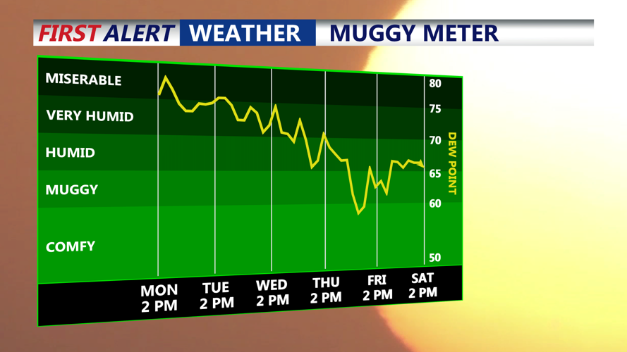
By Tuesday afternoon, the region will be fully entrenched in the warm sector, with high temperatures ranging from the upper 80s to low 90s once again and dew points climbing into the low to mid 70s. An amplifying upper-level trough will push east across the Northeast, driving a cold front toward the area by late day.
This setup will increase shear further, raising the potential for severe storms. However, forecast uncertainty remains over how long Tuesday morning convection might linger, and whether cloud cover could suppress afternoon instability. If the clouds break early, models suggest enough clearing to support moderate destabilization.

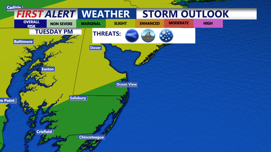
The latest outlook has upgraded most of the region to a Slight (Level 2 of 5) risk for severe thunderstorms Tuesday, with damaging wind gusts the main concern.
Flash flooding is also a significant threat, with the Excessive Rainfall Outlook placing Delmarva in a Slight (Level 2 of 4) risk. Precipitable water values could climb to 2–2.5 inches, and deep warm cloud layers will make storms efficient rain producers. If showers repeatedly train over the same areas, the flooding potential will be enhanced.
The cold front will slowly work across the region late Tuesday into early Wednesday, ending the severe threat by around midnight to 3 a.m. Some lingering showers may persist near the coast Wednesday morning, with lows dropping into the low 70s.

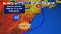
By later Wednesday and Thursday, drier air and building high pressure will bring relief from the oppressive humidity. Although an upper-level trough will remain over the Northeast and Mid-Atlantic, deeper moisture should be limited, keeping any additional showers isolated. Highs will be in the mid to upper 80s with more comfortable conditions.

The forecast turns much more favorable as high pressure settles over the region heading into Friday and the Fourth of July weekend. Temperatures will hold in the mid to upper 80s during the day, with dew points dipping into the low to mid-60s, delivering comfortable summer weather to close out the week.