


DELMARVA- A cloudier end to the weekend with Sunday showers, then a coastal low brings a cold rain on Tuesday.

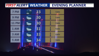
High pressure is sliding off the east coast this evening, with light winds and cold temperatures. Readings quickly fall through the 30s then into the 20s. Increasing clouds overnight will help hold temperatures in the mid 20s to around 30 degrees, with rising temperatures into Sunday morning.

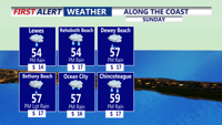
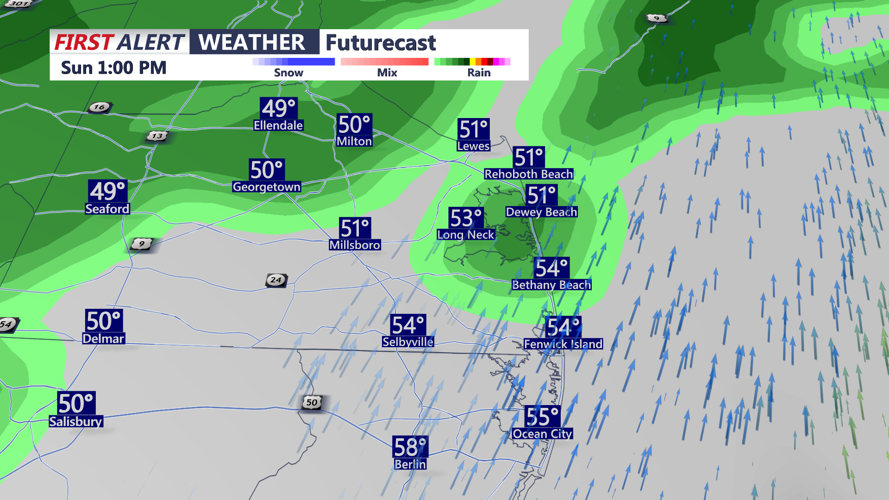
A developing low moving out of the Midwest will bring mostly light rain to Delmarva on Sunday. Rainfall totals are expected to range from 0.10 to 0.25 inches as the system tracks toward the Great Lakes, placing the region on the warm side of the storm. Temperatures will climb into the low to mid 50s before a cold front moves offshore late Sunday. Southwest winds of 10 to 20 mph may gust up to 30 mph during the afternoon. By early Monday, temperatures will drop back to around freezing.

Another shot of cold, dry air arrives Monday, bringing highs in the mid 40s and another breezy day across the peninsula. Overnight lows Monday night will fall once again near 30 degrees.

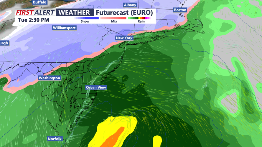
Attention then turns to a coastal low forecast to approach on Tuesday. While confidence remains low regarding the storm’s strength and track, the system will bring a cold rain to Delmarva.
Areas along the coast currently appear most likely to see mainly rain, while inland regions, particularly northwest of the I-95 corridor and well off the beaches, could see a brief period of snow or a rain-snow mix at onset due to the cold air already in place. Any shift in the storm track could alter precipitation types and impacts.
The system will move out Tuesday night, with dry and cold weather returning for Wednesday and Thursday as high pressure builds back into the region, with highs in the 40s and lows in the 20s and 30s.
