



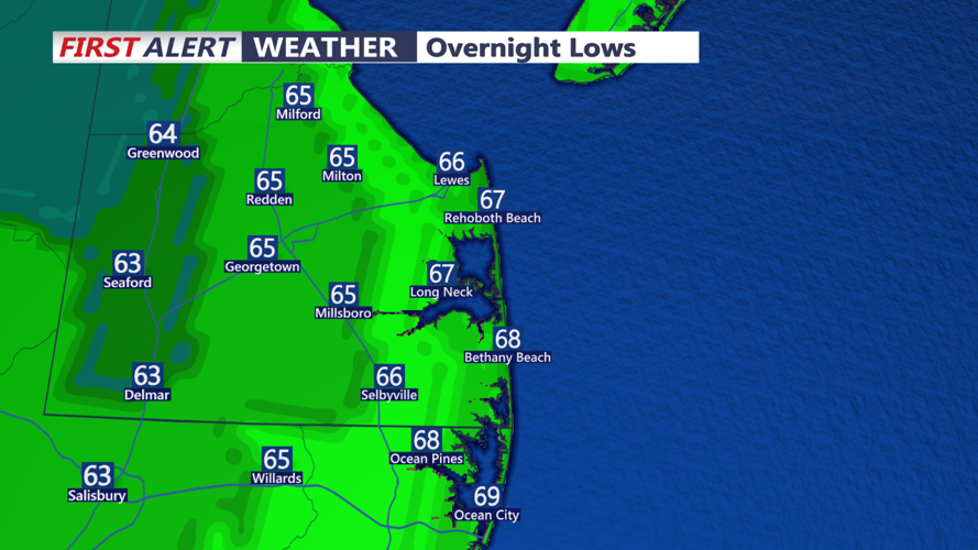

DELMARVA -- High pressure will continue to bring great weather to Delmarva tonight with clear skies and mild temperatures dropping to the low to mid 60s. Expect some areas of fog to develop overnight. While fog could be dense at times, there is some uncertainty about its exact locations. Winds will be light, from the east to northeast, around 5 mph.

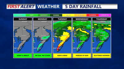
On Sunday morning, fog is likely across much of the southern and eastern half of the region. As the fog clears, another sunny day is anticipated, with temperatures similar to today or slightly cooler. Daytime highs will reach the upper 70s to near 80 degrees, with east to southeast winds increasing to 10-15 mph, gusting up to 25 mph near the shore.
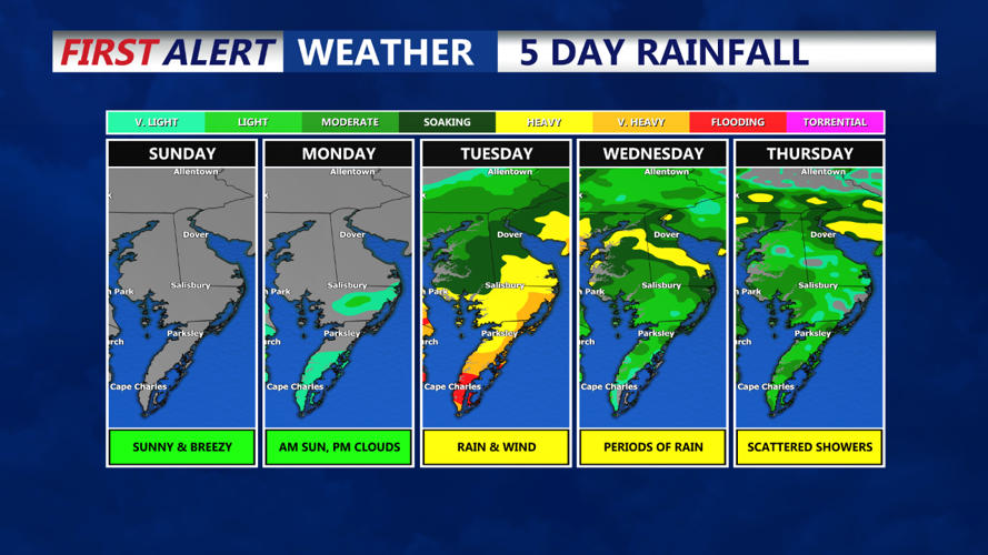
High pressure over New England will shift offshore, maintaining influence over the region. Light east to northeast winds will continue, keeping low-level moisture in place and allowing for patchy fog and low clouds during the late night and early morning hours. However, winds should be strong enough to prevent widespread fog. Monday will remain mostly clear with some upper-level cirrus clouds moving in later in the day as a low pressure begins to develop southeast of the region. A few showers could reach southern parts of Delmarva by Monday night. Temperatures will range from the mid-50s to around 60 at night, with highs near 80 during the day.

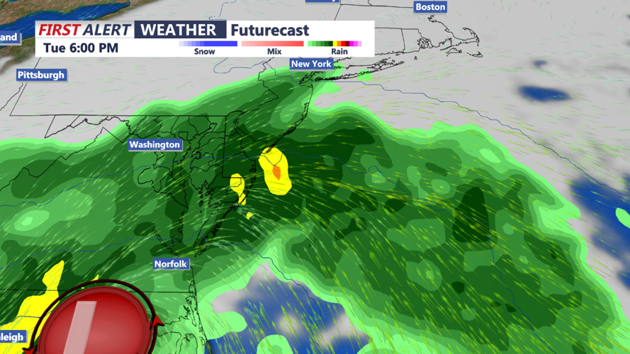
A disturbance off the southeastern U.S. coast could bring increasing chances of rain to Delmarva by Tuesday as high pressure moves further offshore. There remains considerable uncertainty regarding the development and path of this system, but current guidance suggests a plume of tropical moisture could affect the region with heavy rain, wind and coastal flooding. Precipitation chances will peak around 40-50% Tuesday night into Wednesday. Highs will be in the upper 70s with increasing humidity, as dew points rise into the mid-60s to near 70 degrees.
